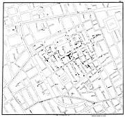
Ús global del fitxer «Fitxer:Snow-cholera-map-1.jpg»
Aparença
This page shows where a file is used on other wikis. You can also find that information at the bottom of the file description page.

Utilització a ar.wikipedia.org
- نظام معلومات جغرافية
- تفشي وباء الكوليرا في شارع برود عام 1854
- علم الأوبئة البيئية
- المكانية الرقمية
- مستخدم:Amany aljemzawy/ملعب
Utilització a bg.wikipedia.org
Utilització a bh.wikipedia.org
Utilització a bn.wikipedia.org
Utilització a ca.wikipedia.org
Utilització a de.wikipedia.org
- Geoinformationssystem
- Benutzer:Anitagraser/Baustelle/WikiProjekt Geoinformatik/Geoinformationssystem
- GIS im Gesundheitswesen
Utilització a de.wikiversity.org
Utilització a en.wikipedia.org
- Human geography
- Natural experiment
- Water purification
- Public health
- John Snow
- Slow sand filter
- Portal:Medicine
- Health geography
- Thematic map
- User talk:Mathwhiz 29
- Statistical graphics
- Wikipedia:Featured pictures/Diagrams, drawings, and maps/Maps
- 1846–1860 cholera pandemic
- 1854 Broad Street cholera outbreak
- Talk:1854 Broad Street cholera outbreak
- User:Aetarrell/Practice
- GIS and public health
- Wikipedia:WikiProject Medicine/Recognized content
- Dot distribution map
- History of water filters
- Wikipedia:Reference desk/Archives/Humanities/2010 August 24
- History of water supply and sanitation
- User talk:Sarason
- Portal:Geography/Intro/Image
- User talk:Smileguy91
- User:Life in General/Userboxes/HumanGeography
- User talk:Gwooodward
- Portal:Geography/Intro/6
- User:Wouterstomp/test
- Charles Cheffins
- User talk:Khamar
- User talk:Joshualouie711
- User talk:OfficialNeon
- User talk:Sahara4u/Archive 5
