Fitxer:Autoroute A10.jpg
Aparença
Autoroute_A10.jpg (640 × 480 píxels, mida del fitxer: 54 Ko, tipus MIME: image/jpeg)
Historial del fitxer
Cliqueu una data/hora per veure el fitxer tal com era aleshores.
| Data/hora | Miniatura | Dimensions | Usuari/a | Comentari | |
|---|---|---|---|---|---|
| actual | 17:44, 14 oct 2012 |  | 640 × 480 (54 Ko) | Olybrius | Reverted to version as of 20:32, 18 January 2005 |
| 17:44, 14 oct 2012 |  | 640 × 480 (54 Ko) | Olybrius | Reverted to version as of 20:32, 18 January 2005 | |
| 08:36, 14 juny 2007 |  | 640 × 480 (141 Ko) | Grondin | Correction des niveaux d'entrées des couleurs. Utilisation de GIMP 2.3.18 | |
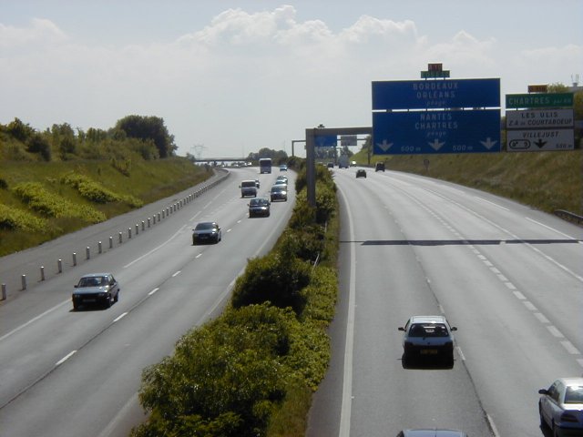
| 21:32, 18 gen 2005 |  | 640 × 480 (54 Ko) | Michiel1972 | {{PD}} - From FR.wik: Prise de vue à la hauteur de Villebon-sur-Yvette, dans l'Essonne. Sur le panneau, on peut lire les directions de Bordeaux, Orléans, Nantes et Chartres. |
Ús del fitxer
La pàgina següent utilitza aquest fitxer:
Ús global del fitxer
Utilització d'aquest fitxer en altres wikis:
- Utilització a ba.wikipedia.org
- Utilització a be-tarask.wikipedia.org
- Utilització a be.wikipedia.org
- Utilització a bg.wikipedia.org
- Utilització a bs.wikipedia.org
- Utilització a cs.wikipedia.org
- Utilització a de.wikipedia.org
- Utilització a el.wikipedia.org
- Utilització a en.wikipedia.org
- Utilització a en.wikivoyage.org
- Utilització a es.wikipedia.org
- Utilització a et.wikipedia.org
- Utilització a eu.wikipedia.org
- Utilització a ext.wikipedia.org
- Utilització a fa.wikipedia.org
- Utilització a fr.wikipedia.org
- Utilització a hr.wikipedia.org
- Utilització a hu.wikipedia.org
- Utilització a it.wikipedia.org
- Utilització a it.wikivoyage.org
- Utilització a ko.wikipedia.org
- Utilització a nl.wikipedia.org
- Utilització a nn.wikipedia.org
- Utilització a no.wikipedia.org
- Utilització a pl.wikipedia.org
- Utilització a ro.wikipedia.org
- Utilització a ru.wikipedia.org
- Utilització a sh.wikipedia.org
Vegeu més usos globals d'aquest fitxer.


