
Fitxer:Barrier north Jerusalem.jpg
Mida d'aquesta previsualització: 582 × 600 píxels. Altres resolucions: 233 × 240 píxels | 466 × 480 píxels | 809 × 834 píxels.
Fitxer original (809 × 834 píxels, mida del fitxer: 362 Ko, tipus MIME: image/jpeg)
| Aquest fitxer i la informació mostrada a continuació provenen del dipòsit multimèdia lliure Wikimedia Commons. |
Resum
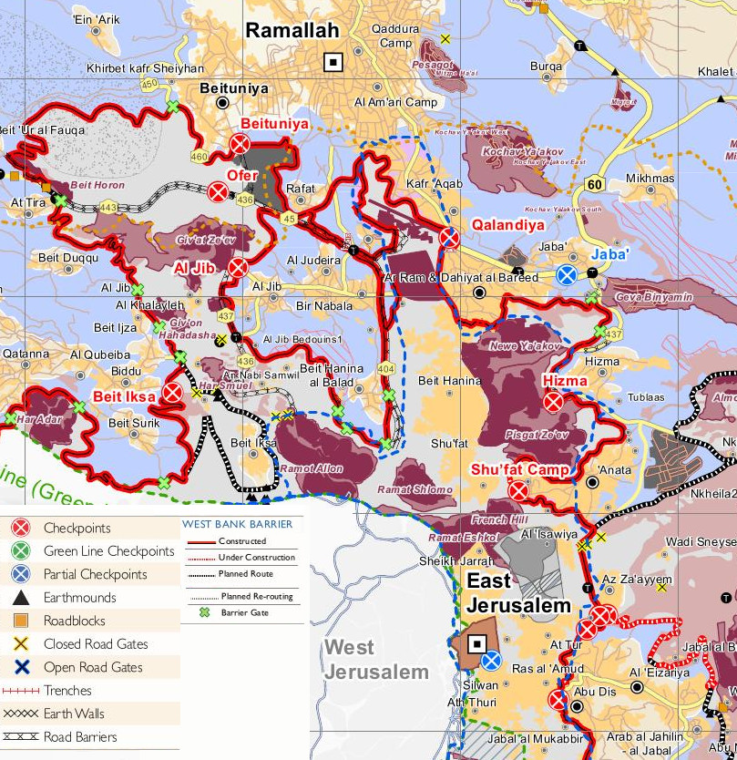
| Descripció |
English: The Israeli barrier in northern Jerusalem beyond the "Green Line", separating Palestinian land in East Jerusalem from the rest of the West Bank. Also separating the West Bank from Jerusalem. |
| Data | |
| Font | Treball propi. Derived from Humanitarian Atlas (file size 49 MB), OCHAoPt, December 2012, which is considered public domain. |
| Autor | Wickey-nl |
Llicència
Jo, el titular dels drets d'autor d'aquest treball, el public sota la següent llicència:
Aquest fitxer està subjecte a la llicència de Creative Commons Reconeixement 3.0 No adaptada.
- Sou lliure de:
- compartir – copiar, distribuir i comunicar públicament l'obra
- adaptar – fer-ne obres derivades
- Amb les condicions següents:
- reconeixement – Heu de donar la informació adequada sobre l'autor, proporcionar un enllaç a la llicència i indicar si s'han realitzat canvis. Podeu fer-ho amb qualsevol mitjà raonable, però de cap manera no suggereixi que l'autor us dóna suport o aprova l'ús que en feu.

Historial del fitxer
Cliqueu una data/hora per veure el fitxer tal com era aleshores.
| Data/hora | Miniatura | Dimensions | Usuari/a | Comentari | |
|---|---|---|---|---|---|
| actual | 17:02, 17 març 2014 | | 809 × 834 (362 Ko) | Wickey-nl | User created page with UploadWizard |
Ús del fitxer
Les 3 pàgines següents utilitzen aquest fitxer:
Ús global del fitxer
Utilització d'aquest fitxer en altres wikis:
- Utilització a ar.wikipedia.org
- Utilització a bn.wikipedia.org
- Utilització a en.wikipedia.org
- Utilització a he.wikipedia.org
- Utilització a nl.wikipedia.org
- Utilització a no.wikipedia.org