Fitxer:Canton de Moisdon-la-Rivière(Position).png
Aparença
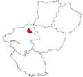
Canton_de_Moisdon-la-Rivière(Position).png (418 × 314 píxels, mida del fitxer: 39 Ko, tipus MIME: image/png)
Historial del fitxer
Cliqueu una data/hora per veure el fitxer tal com era aleshores.
| Data/hora | Miniatura | Dimensions | Usuari/a | Comentari | |
|---|---|---|---|---|---|
| actual | 15:27, 19 jul 2007 |  | 418 × 314 (39 Ko) | GL | Reverted to earlier revision |
| 15:26, 19 jul 2007 |  | 548 × 507 (15 Ko) | GL | Reverted to earlier revision | |
| 21:21, 5 feb 2007 |  | 418 × 314 (39 Ko) | Yun | Reverted to earlier revision | |
| 18:45, 5 feb 2007 |  | 548 × 507 (15 Ko) | Moa mrick | Rétablissement de la version précédente | |
| 23:14, 4 feb 2007 |  | 418 × 314 (39 Ko) | Yun | Reverted to earlier revision | |
| 22:19, 4 feb 2007 |  | 548 × 507 (15 Ko) | Moa mrick | Rétablissement de la version précédente | |
| 19:55, 3 feb 2007 |  | 418 × 314 (39 Ko) | Yun | Reverted to earlier revision | |
| 18:32, 23 ago 2006 |  | 548 × 507 (15 Ko) | Moa mrick | ||
| 19:43, 25 abr 2005 |  | 418 × 314 (39 Ko) | TigH | '''Description:''' Map for localisazion of cantons of Bretagne, (now Pays-de-Loire), region in France '''Source:''' made by Hervé Tigier in april 2005 from another large map (published in 1990) {{PD}} [[Category:Cant |
Ús del fitxer
La pàgina següent utilitza aquest fitxer:
Ús global del fitxer
Utilització d'aquest fitxer en altres wikis:
- Utilització a br.wikipedia.org
- Utilització a de.wikipedia.org


