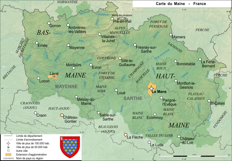
Fitxer:Carte maine.svg
Aparença

Mida d'aquesta previsualització PNG del fitxer SVG: 800 × 554 píxels. Altres resolucions: 320 × 222 píxels | 640 × 443 píxels | 1.024 × 709 píxels | 1.280 × 886 píxels | 2.560 × 1.772 píxels | 1.813 × 1.255 píxels.
Fitxer original (fitxer SVG, nominalment 1.813 × 1.255 píxels, mida del fitxer: 3,76 Mo)
Historial del fitxer
Cliqueu una data/hora per veure el fitxer tal com era aleshores.
| Data/hora | Miniatura | Dimensions | Usuari/a | Comentari | |
|---|---|---|---|---|---|
| actual | 13:27, 20 ago 2021 |  | 1.813 × 1.255 (3,76 Mo) | Esprit04 | limites |
| 18:23, 5 feb 2021 |  | 1.812 × 1.254 (3,41 Mo) | Esprit04 | m | |
| 21:32, 4 feb 2021 |  | 1.811 × 1.253 (3,38 Mo) | Esprit04 | m | |
| 14:21, 1 feb 2021 |  | 1.811 × 1.253 (3,38 Mo) | Esprit04 | Meilleure version | |
| 22:03, 4 maig 2011 |  | 2.816 × 2.112 (64 Ko) | VIGNERON | ||
| 12:00, 9 març 2008 |  | 2.816 × 2.112 (72 Ko) | Esprit04 | {{Information |Description=Carte de l'ancienne province française du Maine Map of the ancient french province Maine |Source=travail personnel |Date=09/03/2008 |Author= Koostia |Permission= |other_versions= }} Category:Sarthe[[Catego | |
| 11:36, 9 març 2008 |  | 2.816 × 2.112 (72 Ko) | Esprit04 | {{Information |Description=Carte de l'ancienne province française du Maine Map of the ancient french province Maine |Source=travail personnel |Date=09/03/2008 |Author= Koostia |Permission= |other_versions= }} Category:Sarthe[[Catego | |
| 11:36, 9 març 2008 |  | 2.816 × 2.112 (72 Ko) | Esprit04 | {{Information |Description=Carte de l'ancienne province française du Maine Map of the ancient french province Maine |Source=travail personnel |Date=09/03/2008 |Author= Koostia |Permission= |other_versions= }} Category:Sarthe[[Categor | |
| 11:34, 9 març 2008 |  | 2.816 × 2.112 (72 Ko) | Esprit04 | {{Information |Description=Carte de l'ancienne province française du Maine Map of the ancient french province Maine |Source=travail personnel |Date=09/03/2008 |Author= Koostia |Permission= |other_versions= }} Category:Sarthe[[Categor | |
| 11:28, 9 març 2008 |  | 2.816 × 2.112 (72 Ko) | Esprit04 | {{Information |Description=Carte de l'ancienne province française du Maine Map of the ancient french province Maine |Source=travail personnel |Date=09/03/2008 |Author= Koostia |Permission= |other_versions= }} Category:Sarthe[[Categor |
Ús del fitxer
La pàgina següent utilitza aquest fitxer:
Ús global del fitxer
Utilització d'aquest fitxer en altres wikis:
- Utilització a de.wikipedia.org
- Utilització a en.wikipedia.org
- Utilització a es.wikipedia.org
- Utilització a fa.wikipedia.org
- Utilització a fr.wikipedia.org
- Utilització a he.wikipedia.org
- Utilització a it.wikipedia.org
- Utilització a lfn.wikipedia.org
- Utilització a nrm.wikipedia.org
- Utilització a pt.wikipedia.org
- Utilització a simple.wikipedia.org

