
Fitxer:Eureka Sound.jpg
Mida d'aquesta previsualització: 800 × 398 píxels. Altres resolucions: 320 × 159 píxels | 640 × 318 píxels | 1.024 × 509 píxels | 1.280 × 637 píxels | 3.000 × 1.492 píxels.
Fitxer original (3.000 × 1.492 píxels, mida del fitxer: 1,68 Mo, tipus MIME: image/jpeg)
| Aquest fitxer i la informació mostrada a continuació provenen del dipòsit multimèdia lliure Wikimedia Commons. |
Resum
| Descripció |
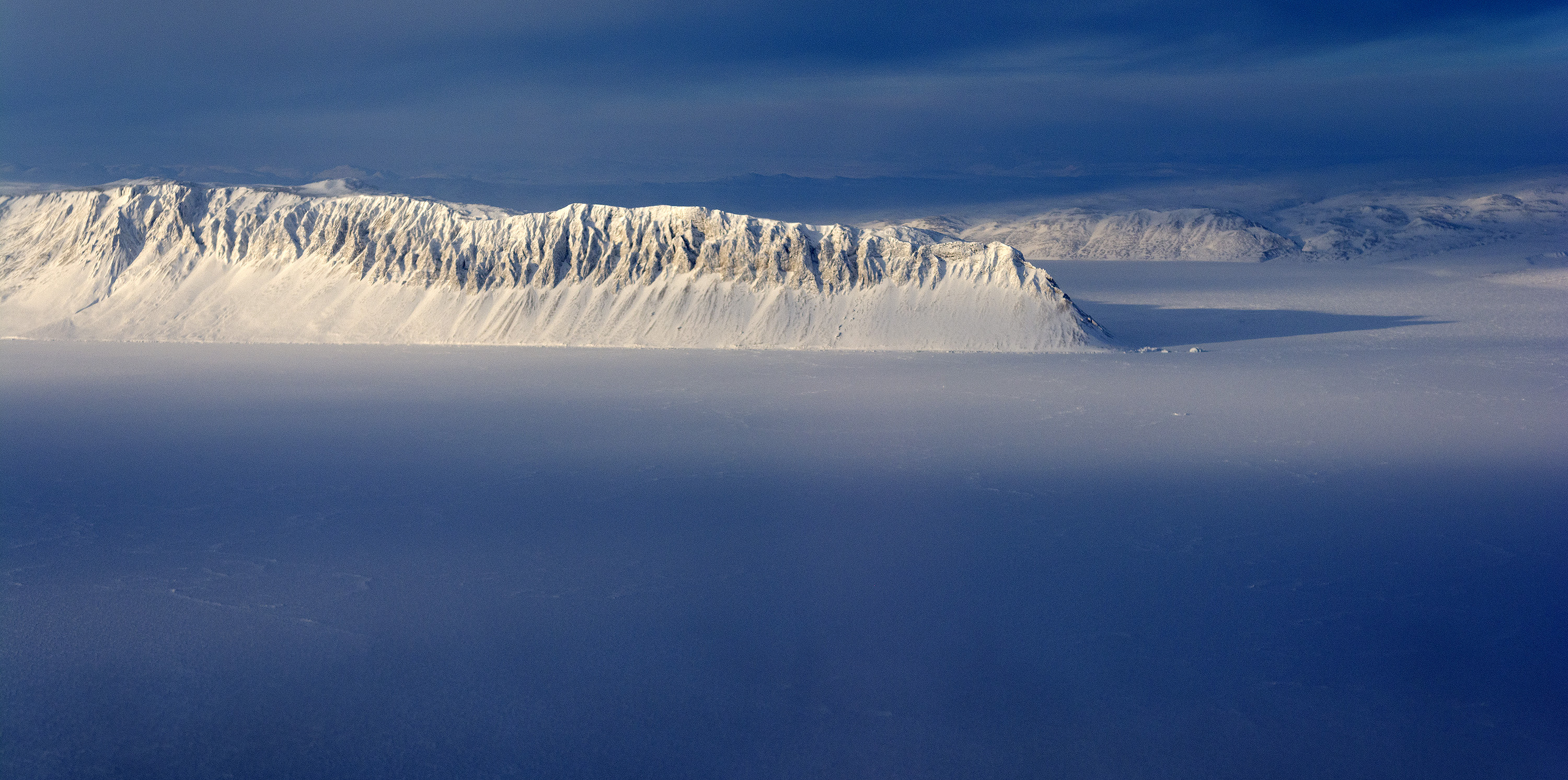
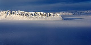
English: Eureka Sound on Ellesmere Island in the Canadian Arctic seen on today's flight. IceBridge teamed up with Canadian scientists on the ground supported through an agreement between the Canadian Space Agency and NASA. The scientists on the ground did ground-based snow depth measurements along twelve 70-km-long profiles while the NASA P-3 was flying overhead and collecting snow depth measurements from the air.
Credit: NASA / Michael Studinger NASA's Operation IceBridge is an airborne science mission to study Earth's polar ice. For more information about IceBridge, visit: www.nasa.gov/icebridge |
| Data | |
| Font | https://www.flickr.com/photos/nasa_ice/13425732263/ |
| Autor | NASA ICE |
Llicència
Aquest fitxer està disponible sota la llicència Creative Commons Reconeixement 2.0 Genèrica.
- Sou lliure de:
- compartir – copiar, distribuir i comunicar públicament l'obra
- adaptar – fer-ne obres derivades
- Amb les condicions següents:
- reconeixement – Heu de donar la informació adequada sobre l'autor, proporcionar un enllaç a la llicència i indicar si s'han realitzat canvis. Podeu fer-ho amb qualsevol mitjà raonable, però de cap manera no suggereixi que l'autor us dóna suport o aprova l'ús que en feu.
| This image was originally posted to Flickr by NASA ICE at https://flickr.com/photos/59345957@N05/13425732263. It was reviewed on 13 de setembre de 2020 by FlickreviewR 2 and was confirmed to be licensed under the terms of the cc-by-2.0. |
Historial del fitxer
Cliqueu una data/hora per veure el fitxer tal com era aleshores.
| Data/hora | Miniatura | Dimensions | Usuari/a | Comentari | |
|---|---|---|---|---|---|
| actual | 14:21, 13 set 2020 | | 3.000 × 1.492 (1,68 Mo) | Prototyperspective | Uploaded a work by NASA ICE from https://www.flickr.com/photos/nasa_ice/13425732263/ with UploadWizard |
Ús del fitxer
La pàgina següent utilitza aquest fitxer:
Ús global del fitxer
Utilització d'aquest fitxer en altres wikis:
- Utilització a ceb.wikipedia.org
- Utilització a en.wikipedia.org
- Utilització a es.wikipedia.org
- Utilització a fr.wikipedia.org
- Utilització a lv.wikipedia.org
- Utilització a www.wikidata.org