Fitxer:Ferndale Eureka RegionHistoricSeismicity.jpg
Aparença
Ferndale_Eureka_RegionHistoricSeismicity.jpg (496 × 590 píxels, mida del fitxer: 355 Ko, tipus MIME: image/jpeg)
Historial del fitxer
Cliqueu una data/hora per veure el fitxer tal com era aleshores.
| Data/hora | Miniatura | Dimensions | Usuari/a | Comentari | |
|---|---|---|---|---|---|
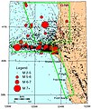
| actual | 03:08, 11 des 2011 |  | 496 × 590 (355 Ko) | Ellin Beltz | {{Information |Description ={{en|1=Dots are from 1985-2003 earthquakes with magnitude greater than 2 near Eureka and Ferndale in northern California. Major roads in white; known active faults in brown. Green boxes refer to active plate interations G |
Ús del fitxer
La pàgina següent utilitza aquest fitxer:
Ús global del fitxer
Utilització d'aquest fitxer en altres wikis:
- Utilització a en.wikipedia.org
- Utilització a fr.wikipedia.org
- Utilització a it.wikipedia.org
- Utilització a ja.wikipedia.org
- Utilització a ms.wikipedia.org


