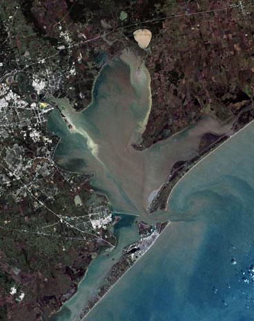
Fitxer:Galveston Bay Landsat.jpg
Aparença
Galveston_Bay_Landsat.jpg (368 × 464 píxels, mida del fitxer: 33 Ko, tipus MIME: image/jpeg)
Historial del fitxer
Cliqueu una data/hora per veure el fitxer tal com era aleshores.
| Data/hora | Miniatura | Dimensions | Usuari/a | Comentari | |
|---|---|---|---|---|---|
| actual | 11:12, 3 set 2017 |  | 368 × 464 (33 Ko) | Ras67 | higher resolution, losslessly cropped from the original |
| 00:43, 3 gen 2012 |  | 247 × 322 (23 Ko) | Ronhjones | (Original text) : Author: United States Geological Service http://landsat.usgs.gov/gallery/detail/370/ This image is a clipped version of a satellite shot of the Houston area (clipping by M. Corazao) |
Ús del fitxer
La pàgina següent utilitza aquest fitxer:
Ús global del fitxer
Utilització d'aquest fitxer en altres wikis:
- Utilització a ceb.wikipedia.org
- Utilització a de.wikipedia.org
- Utilització a en.wikipedia.org
- Utilització a es.wikipedia.org
- Utilització a fa.wikipedia.org
- Utilització a fi.wikipedia.org
- Utilització a fr.wikipedia.org
- Utilització a he.wikipedia.org
- Utilització a ja.wikipedia.org
- Utilització a lt.wikipedia.org
- Utilització a pt.wikipedia.org
- Utilització a www.wikidata.org


