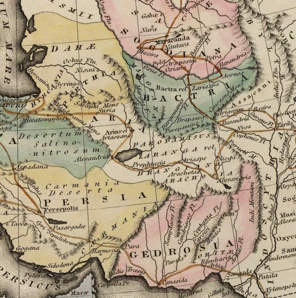
Fitxer:Gedrosia-Map-Route-of-Alexander-1823-Lucas.png
Aparença

Mida d'aquesta previsualització: 596 × 600 píxels. Altres resolucions: 239 × 240 píxels | 477 × 480 píxels | 656 × 660 píxels.
Fitxer original (656 × 660 píxels, mida del fitxer: 881 Ko, tipus MIME: image/png)
Historial del fitxer
Cliqueu una data/hora per veure el fitxer tal com era aleshores.
| Data/hora | Miniatura | Dimensions | Usuari/a | Comentari | |
|---|---|---|---|---|---|
| actual | 18:51, 29 nov 2007 |  | 656 × 660 (881 Ko) | Bejnar | {{Information |Description=Map of the route of Alexander the Great through Gedrosia, Bactria, and Sogdiana part of a map entitled "Alexandri Magni Itinera" based upon Melish (1815) ''Atlas of Ancient Geography'' |Source= scanned from Plate 12 of ''A gener |
Ús del fitxer
Les 2 pàgines següents utilitzen aquest fitxer:
Ús global del fitxer
Utilització d'aquest fitxer en altres wikis:
- Utilització a ar.wikipedia.org
- Utilització a bg.wikipedia.org
- Utilització a cs.wikipedia.org
- Utilització a cv.wikipedia.org
- Utilització a de.wikipedia.org
- Utilització a en.wikipedia.org
- Utilització a eo.wikipedia.org
- Utilització a fr.wikipedia.org
- Utilització a hr.wikipedia.org
- Utilització a hyw.wikipedia.org
- Utilització a id.wikipedia.org
- Utilització a it.wikipedia.org
- Utilització a ko.wikipedia.org
- Utilització a nl.wikipedia.org
- Utilització a pl.wikipedia.org
- Utilització a pt.wikipedia.org
- Utilització a ru.wikipedia.org
- Utilització a sh.wikipedia.org
- Utilització a tr.wikipedia.org
- Utilització a uk.wikipedia.org
- Utilització a www.wikidata.org


