
Fitxer:Greenland edcp relief location map.jpg

Mida d'aquesta previsualització: 424 × 599 píxels. Altres resolucions: 170 × 240 píxels | 340 × 480 píxels | 543 × 768 píxels | 1.181 × 1.669 píxels.
Fitxer original (1.181 × 1.669 píxels, mida del fitxer: 1,26 Mo, tipus MIME: image/jpeg)
| Aquest fitxer i la informació mostrada a continuació provenen del dipòsit multimèdia lliure Wikimedia Commons. |
Resum
| Descripció |
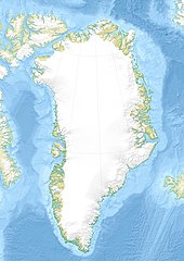
English: Relief location map of Greenland.
|
| Data | |
| Font | Treball propi |
| Autor | Uwe Dedering |
| Altres versions |
|


Llicència
Jo, el titular dels drets d'autor d'aquest treball, el public sota les següents llicències:
Aquest fitxer està subjecte a la llicència de Creative Commons Reconeixement i Compartir Igual 3.0 No adaptada.
- Sou lliure de:
- compartir – copiar, distribuir i comunicar públicament l'obra
- adaptar – fer-ne obres derivades
- Amb les condicions següents:
- reconeixement – Heu de donar la informació adequada sobre l'autor, proporcionar un enllaç a la llicència i indicar si s'han realitzat canvis. Podeu fer-ho amb qualsevol mitjà raonable, però de cap manera no suggereixi que l'autor us dóna suport o aprova l'ús que en feu.
- compartir igual – Si modifiqueu, transformeu, o generareu amb el material, haureu de distribuir les vostres contribucions sota una llicència similar o una de compatible com l'original

|
S'autoritza la còpia, la distribució i la modificació d'aquest document sota els termes de la llicència de documentació lliure GNU versió 1.2 o qualsevol altra versió posterior que publiqui la Free Software Foundation; sense seccions invariants, ni textos de portada, ni textos de contraportada. S'inclou una còpia d'aquesta llicència en la secció titulada GNU Free Documentation License. |
Podeu seleccionar la llicència que vulgueu.
Historial del fitxer
Cliqueu una data/hora per veure el fitxer tal com era aleshores.
| Data/hora | Miniatura | Dimensions | Usuari/a | Comentari | |
|---|---|---|---|---|---|
| actual | 18:09, 1 des 2010 | | 1.181 × 1.669 (1,26 Mo) | Uwe Dedering | {{Information |Description={{en|1= Relief location map of Greenland. * Projection: EquiDistantConicProjection. * Area of interest: :* N: 85.0° N :* S: 59.0° N :* W: -75.0° E :* E: -10.0° E * Projection center: :* NS: 72.0° N :* WE: -42.5° E *Standar |
Ús del fitxer
Les 2 pàgines següents utilitzen aquest fitxer:
Ús global del fitxer
Utilització d'aquest fitxer en altres wikis:
- Utilització a ast.wikipedia.org
- Utilització a az.wikipedia.org
- Qrenlandiya adası
- Qrenland dənizi
- Şablon:Yer xəritəsi Danimarka Qrenlandiya
- Baffin dənizi
- Devis boğazı
- Danimarka boğazı
- Linkoln dənizi
- Vandel dənizi
- Nares boğazı
- Fram (boğaz)
- İrminger dənizi
- Disko boğazı (körfəz)
- Piri Torpağı
- Disko adası
- Morris Cesup burnu
- ATOW1996
- Ella adası
- Şannon adası
- Ammassalik adası
- İmer adası
- Toyfelşloss dağı
- İllorsuit adası
- Uummannak fiordu
- Skorsbi körfəzi
- Coğrafiya Cəmiyyəti adası
- Store Koldevey adası
- Hans adası
- Uunartoq Qeqertoq
- Qunbyorn dağı
- Aleksandr burnu (Qrenlandiya)
- York burnu (Qrenlandiya)
- Farvel burnu
- Nordostrunningen burnu
- Nuussuaq yarımadası
- Utilització a ba.wikipedia.org
- Utilització a bcl.wikipedia.org
- Utilització a be-tarask.wikipedia.org
- Utilització a be.wikipedia.org
- Utilització a bg.wikipedia.org
Vegeu més usos globals d'aquest fitxer.