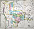
Fitxer:Hooker Map of the State of Coahuila and Texas 1834 UTA.jpg
Aparença

Mida d'aquesta previsualització: 716 × 600 píxels. Altres resolucions: 287 × 240 píxels | 573 × 480 píxels | 917 × 768 píxels | 1.222 × 1.024 píxels | 2.456 × 2.058 píxels.
Fitxer original (2.456 × 2.058 píxels, mida del fitxer: 3,77 Mo, tipus MIME: image/jpeg)
Historial del fitxer
Cliqueu una data/hora per veure el fitxer tal com era aleshores.
| Data/hora | Miniatura | Dimensions | Usuari/a | Comentari | |
|---|---|---|---|---|---|
| actual | 21:28, 23 jul 2019 |  | 2.456 × 2.058 (3,77 Mo) | Michael Barera | == {{int:filedesc}} == {{Map |title = ''Map of the State of Coahuila and Texas'' |description = {{en|Philadelphia engraver, printer, map publisher, and instrument maker William Hooker's Map of Coahuila and Texas first appeared in an 1833 promotional book on Texas by Mary Austin Holley (1784-1846), a first cousin of the famous Texas colonizer Stephen F. Austin. Holley and her publisher, Armstrong & Plaskitt of Baltimore substituted Hooker's map when Henry S. Tanner, the pub... |
Ús del fitxer
La pàgina següent utilitza aquest fitxer:
Ús global del fitxer
Utilització d'aquest fitxer en altres wikis:
- Utilització a cs.wikipedia.org
- Utilització a el.wikipedia.org
- Utilització a en.wikipedia.org
- Utilització a es.wikipedia.org
- Utilització a ja.wikipedia.org
- Utilització a ro.wikipedia.org
- Utilització a sv.wikipedia.org


