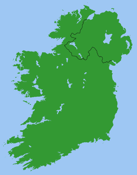
Fitxer:Ireland.svg
Aparença

Mida d'aquesta previsualització PNG del fitxer SVG: 471 × 599 píxels. Altres resolucions: 188 × 240 píxels | 377 × 480 píxels | 603 × 768 píxels | 804 × 1.024 píxels | 1.609 × 2.048 píxels | 2.200 × 2.800 píxels.
Fitxer original (fitxer SVG, nominalment 2.200 × 2.800 píxels, mida del fitxer: 204 Ko)
Historial del fitxer
Cliqueu una data/hora per veure el fitxer tal com era aleshores.
| Data/hora | Miniatura | Dimensions | Usuari/a | Comentari | |
|---|---|---|---|---|---|
| actual | 22:49, 13 març 2007 |  | 2.200 × 2.800 (204 Ko) | Nickshanks | increased default size, modified lough Erne |
| 22:19, 13 març 2007 |  | 550 × 700 (204 Ko) | Nickshanks | Map of Ireland, with North-South boundary delimited.<br/> SVG should be fairly easy to alter or expand. Northern Ireland is a separate group element<br/> Needs rivers adding. Anyone care to do this? Originally derived from Image:Lough-Neagh.svg. |
Ús del fitxer
Les 2 pàgines següents utilitzen aquest fitxer:
Ús global del fitxer
Utilització d'aquest fitxer en altres wikis:
- Utilització a ab.wikipedia.org
- Utilització a en.wikipedia.org
- Michael Collins (Irish leader)
- Irish Boundary Commission
- Talk:Ireland (disambiguation)
- Repartition of Ireland
- User talk:BrownHairedGirl/Archive/Archive 012
- User:Roadnote/Ireland
- Wikipedia talk:WikiProject Eurovision/Archive 3
- List of Irish Presbyteries
- National symbols of Ireland, the Republic of Ireland and Northern Ireland
- Utilització a es.wikipedia.org
- Utilització a fa.wikipedia.org
- Utilització a fr.wikipedia.org
- Utilització a ga.wikipedia.org
- Utilització a it.wikipedia.org
- Utilització a no.wikipedia.org
- Utilització a pl.wikipedia.org
- Utilització a pt.wikipedia.org
- Utilització a ru.wikipedia.org
- Utilització a simple.wikipedia.org
- Utilització a sl.wikipedia.org
- Utilització a sv.wikipedia.org

