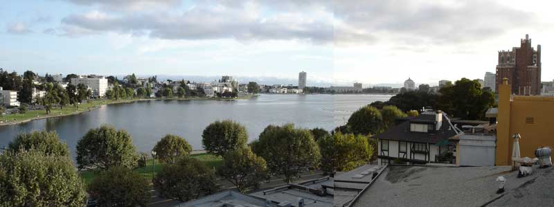
Fitxer:Lake Merritt Oakland California panorama.jpg
Aparença
Lake_Merritt_Oakland_California_panorama.jpg (800 × 299 píxels, mida del fitxer: 27 Ko, tipus MIME: image/jpeg)
Historial del fitxer
Cliqueu una data/hora per veure el fitxer tal com era aleshores.
| Data/hora | Miniatura | Dimensions | Usuari/a | Comentari | |
|---|---|---|---|---|---|
| actual | 17:35, 19 juny 2009 | 800 × 299 (27 Ko) | File Upload Bot (Magnus Manske) | {{BotMoveToCommons|en.wikipedia|year={{subst:CURRENTYEAR}}|month={{subst:CURRENTMONTHNAME}}|day={{subst:CURRENTDAY}}}} {{Information |Description={{en|Composite of two images taken by Aran Johnson on September 8, 2005 at 18:42 PM local time. Looking wes |
Ús del fitxer
La pàgina següent utilitza aquest fitxer:
Ús global del fitxer
Utilització d'aquest fitxer en altres wikis:
- Utilització a ang.wikipedia.org
- Utilització a ar.wikipedia.org
- Utilització a arz.wikipedia.org
- Utilització a be.wikipedia.org
- Utilització a bg.wikipedia.org
- Utilització a ce.wikipedia.org
- Utilització a cs.wikipedia.org
- Utilització a cy.wikipedia.org
- Utilització a de.wikipedia.org
- Utilització a el.wikipedia.org
- Utilització a en.wikipedia.org
- Utilització a en.wikivoyage.org
- Utilització a fr.wikipedia.org
- Utilització a ga.wikipedia.org
- Utilització a glk.wikipedia.org
- Utilització a gl.wikipedia.org
- Utilització a hu.wikipedia.org
- Utilització a hy.wikipedia.org
- Utilització a is.wikipedia.org
- Utilització a it.wikipedia.org
- Utilització a ml.wikipedia.org
- Utilització a mzn.wikipedia.org
- Utilització a nl.wikipedia.org
- Utilització a nn.wikipedia.org
- Utilització a no.wikipedia.org
- Utilització a oc.wikipedia.org
- Utilització a os.wikipedia.org
- Utilització a pl.wikipedia.org
- Utilització a pt.wikipedia.org
- Utilització a ru.wikipedia.org
- Utilització a sr.wikipedia.org
- Utilització a th.wikipedia.org
- Utilització a tl.wikipedia.org
- Utilització a tr.wikipedia.org
- Utilització a tt.wikipedia.org
- Utilització a ur.wikipedia.org
- Utilització a www.wikidata.org
- Utilització a zh.wikipedia.org


