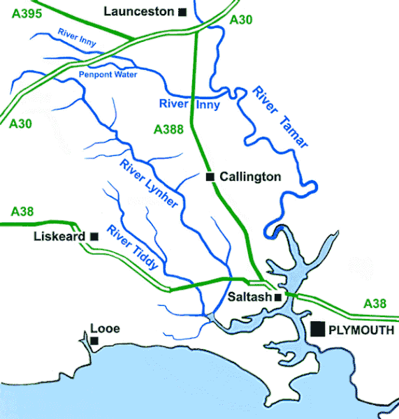
Fitxer:MapRiversSoutheastCornwallUK.gif
Aparença

Mida d'aquesta previsualització: 571 × 600 píxels. Altres resolucions: 229 × 240 píxels | 600 × 630 píxels.
Fitxer original (600 × 630 píxels, mida del fitxer: 30 Ko, tipus MIME: image/gif)
Historial del fitxer
Cliqueu una data/hora per veure el fitxer tal com era aleshores.
| Data/hora | Miniatura | Dimensions | Usuari/a | Comentari | |
|---|---|---|---|---|---|
| actual | 14:13, 17 abr 2010 |  | 600 × 630 (30 Ko) | Andy F | {{Information |Description=A sketch map of the Rivers of southeast Cornwall, United Kingdom |Source={{own}} |Date=2010-04-17 |Author=Andy F |Permission= |other_versions= }} Category:Cornwall Category:Rivers of Cornwall [[Category:M |
Ús del fitxer
La pàgina següent utilitza aquest fitxer:
Ús global del fitxer
Utilització d'aquest fitxer en altres wikis:
- Utilització a arz.wikipedia.org
- Utilització a br.wikipedia.org
- Utilització a en.wikipedia.org
- Utilització a eu.wikipedia.org
- Utilització a fr.wikipedia.org
- Utilització a ga.wikipedia.org
- Utilització a hu.wikipedia.org
- Utilització a it.wikipedia.org
- Utilització a simple.wikipedia.org
- Utilització a sr.wikipedia.org
- Utilització a www.wikidata.org

