Fitxer:Middle-settlement.png
Aparença
Middle-settlement.png (638 × 447 píxels, mida del fitxer: 140 Ko, tipus MIME: image/png)
Historial del fitxer
Cliqueu una data/hora per veure el fitxer tal com era aleshores.
| Data/hora | Miniatura | Dimensions | Usuari/a | Comentari | |
|---|---|---|---|---|---|
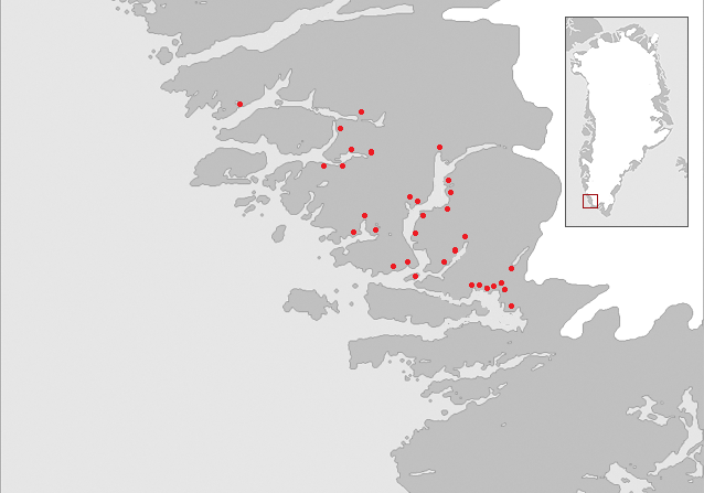
| actual | 09:54, 8 des 2006 |  | 638 × 447 (140 Ko) | Masae~commonswiki | {{Information |Description=Map of the "Middle settlement" of the Norse in medieval Greenland. No written documents of this settlement exist and the name Middle settlement is constructed by modern archaeologists. The red dots indicate known Norse farm ruin |
| 17:23, 7 des 2006 |  | 638 × 510 (86 Ko) | Masae~commonswiki | {{Information |Description=Map of the "Middle settlement" of the Norse in medieval Greenland. No written documents of this settlement exist and the name Middle settlement is constructed by modern archaeologists. The red dots indicate known Norse farm ruin | |
| 16:46, 7 des 2006 |  | 638 × 603 (83 Ko) | Masae~commonswiki | {{Information |Description=Map of the "Middle settlement" of the Norse in medieval Greenland. No written documents of this settlement exist and the name Middle settlement is constructed by modern archaeologists. |Source=Saga trails, Jette Arneborg, Danma |
Ús del fitxer
Les 2 pàgines següents utilitzen aquest fitxer:
Ús global del fitxer
Utilització d'aquest fitxer en altres wikis:
- Utilització a da.wikipedia.org
- Utilització a de.wikipedia.org
- Utilització a en.wikipedia.org
- Utilització a es.wikipedia.org
- Utilització a fi.wikipedia.org
- Utilització a fr.wikipedia.org
- Utilització a is.wikipedia.org
- Utilització a uk.wikipedia.org
- Utilització a zh.wikipedia.org


