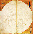
Fitxer:North Atlantic map from Vesconte c.1321 (Lyon) atlas.jpg
Aparença

Mida d'aquesta previsualització: 569 × 600 píxels. Altres resolucions: 228 × 240 píxels | 455 × 480 píxels | 728 × 768 píxels | 971 × 1.024 píxels | 2.443 × 2.576 píxels.
Fitxer original (2.443 × 2.576 píxels, mida del fitxer: 1,01 Mo, tipus MIME: image/jpeg)
Historial del fitxer
Cliqueu una data/hora per veure el fitxer tal com era aleshores.
| Data/hora | Miniatura | Dimensions | Usuari/a | Comentari | |
|---|---|---|---|---|---|
| actual | 18:52, 19 juny 2011 |  | 2.443 × 2.576 (1,01 Mo) | Walrasiad | {{Information |Description ={{en|1= Map of the north Atlantic (including coasts of France, Britain and Ireland) from the eighth sheet of the atlas signed by Genoese cartographer Pietro Vesconte, but undated (est. c.1321), held by |
Ús del fitxer
La pàgina següent utilitza aquest fitxer:
Ús global del fitxer
Utilització d'aquest fitxer en altres wikis:
- Utilització a bn.wikipedia.org
- Utilització a en.wikipedia.org
- Utilització a es.wikipedia.org
- Utilització a uk.wikipedia.org

