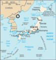
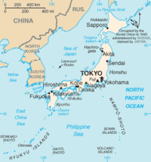
Fitxer:North Korea launch site in Sea of Japan map.png
Aparença
North_Korea_launch_site_in_Sea_of_Japan_map.png (329 × 353 píxels, mida del fitxer: 13 Ko, tipus MIME: image/png)
Historial del fitxer
Cliqueu una data/hora per veure el fitxer tal com era aleshores.
| Data/hora | Miniatura | Dimensions | Usuari/a | Comentari | |
|---|---|---|---|---|---|
| actual | 13:28, 30 ago 2010 |  | 329 × 353 (13 Ko) | Valentim | Reverted to version as of 01:02, 27 August 2010. Continuing vandalism of User:Idh0854. |
| 10:06, 30 ago 2010 |  | 329 × 353 (13 Ko) | Garam | Reverted to version as of 20:22, 8 April 2009 // First contribution. | |
| 02:02, 27 ago 2010 |  | 329 × 353 (13 Ko) | 84user | Reverted to version as of 20:22, 8 April 2009; edit warriors please do not edit war this again | |
| 14:44, 24 ago 2010 |  | 329 × 353 (17 Ko) | Garam | Reverted to version as of 09:43, 22 August 2010 // impartial.. | |
| 14:58, 22 ago 2010 |  | 329 × 353 (13 Ko) | Valentim | Reverted to version as of 08:54, 22 August 2010. See discussion here | |
| 10:43, 22 ago 2010 |  | 329 × 353 (17 Ko) | Garam | Reverted to version as of 06:47, 22 August 2010 // Sorry~ North korea called '조선동해'. '조선' is korea. | |
| 09:54, 22 ago 2010 |  | 329 × 353 (13 Ko) | Valentim | Reverted to version as of 23:27, 16 May 2009. Sea is not called "East Sea" in North Korea. | |
| 07:47, 22 ago 2010 |  | 329 × 353 (17 Ko) | Garam | (→ File:Japan sea map.png) | |
| 00:27, 17 maig 2009 |  | 329 × 353 (13 Ko) | 84user | Reverted to version as of 20:22, 8 April 2009; removing changes by Special:Contributions/Worldproject: create a new image do not edit existing ones | |
| 11:52, 15 maig 2009 |  | 329 × 353 (21 Ko) | Worldproject | Deleted not correct subscribes with arrow about Rusians South-Kuril islands |
Ús del fitxer
La pàgina següent utilitza aquest fitxer:
Ús global del fitxer
Utilització d'aquest fitxer en altres wikis:
- Utilització a en.wikipedia.org
- Utilització a es.wikipedia.org
- Utilització a fi.wikipedia.org
- Utilització a fr.wikipedia.org
- Utilització a id.wikipedia.org
- Utilització a it.wikipedia.org
- Utilització a ms.wikipedia.org
- Utilització a ru.wikipedia.org
- Utilització a ru.wikinews.org
- Utilització a th.wikipedia.org
- Utilització a vi.wikipedia.org


