Fitxer:Offa Kent map.gif
Aparença
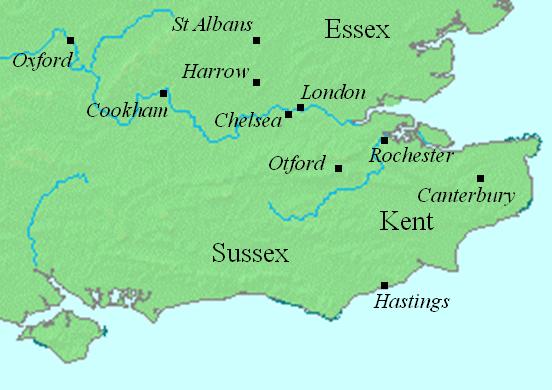
Offa_Kent_map.gif (552 × 390 píxels, mida del fitxer: 69 Ko, tipus MIME: image/gif)
Historial del fitxer
Cliqueu una data/hora per veure el fitxer tal com era aleshores.
| Data/hora | Miniatura | Dimensions | Usuari/a | Comentari | |
|---|---|---|---|---|---|
| actual | 23:19, 12 ago 2008 |  | 552 × 390 (69 Ko) | Elinnea | {{Information |Description=This map shows locations in southeastern England relevant to the article on Offa of Mercia. This file was created using [http://www.demis.nl/home/pages/home.htm DMIS]. On that site it is [http://support.demis.nl/forums/thr |
Ús del fitxer
La pàgina següent utilitza aquest fitxer:
Ús global del fitxer
Utilització d'aquest fitxer en altres wikis:
- Utilització a arz.wikipedia.org
- Utilització a azb.wikipedia.org
- Utilització a el.wikipedia.org
- Utilització a en.wikipedia.org
- Utilització a fa.wikipedia.org
- Utilització a id.wikipedia.org
- Utilització a ja.wikipedia.org
- Utilització a nl.wikipedia.org
- Utilització a sv.wikipedia.org


