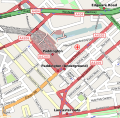
Fitxer:Paddington station location map.svg
Aparença

Mida d'aquesta previsualització PNG del fitxer SVG: 548 × 535 píxels. Altres resolucions: 246 × 240 píxels | 492 × 480 píxels | 787 × 768 píxels | 1.049 × 1.024 píxels | 2.098 × 2.048 píxels.
Fitxer original (fitxer SVG, nominalment 548 × 535 píxels, mida del fitxer: 1,7 Mo)
Historial del fitxer
Cliqueu una data/hora per veure el fitxer tal com era aleshores.
| Data/hora | Miniatura | Dimensions | Usuari/a | Comentari | |
|---|---|---|---|---|---|
| actual | 09:17, 29 jul 2008 |  | 548 × 535 (1,7 Mo) | Edward | ==Summary== {{Information |Description={{en|This map showing the location of London Paddington station. It was created from OpenStreetMap project data, collected by the community. <small>This map may be |
Ús del fitxer
No hi ha pàgines que utilitzin aquest fitxer.
Ús global del fitxer
Utilització d'aquest fitxer en altres wikis:
- Utilització a bn.wikipedia.org
- Utilització a da.wikipedia.org
- Utilització a de.wikipedia.org
- Utilització a en.wikipedia.org
- Utilització a es.wikipedia.org
- Utilització a he.wikipedia.org
- Utilització a mr.wikipedia.org
- Utilització a nl.wikipedia.org
- Utilització a ro.wikipedia.org
- Utilització a simple.wikipedia.org
- Utilització a uk.wikipedia.org
- Utilització a www.wikidata.org


