
Fitxer:Palace of Westminster from Roque's map (1745).jpg

Mida d'aquesta previsualització: 611 × 600 píxels. Altres resolucions: 244 × 240 píxels | 489 × 480 píxels | 662 × 650 píxels.
Fitxer original (662 × 650 píxels, mida del fitxer: 141 Ko, tipus MIME: image/jpeg)
| Aquest fitxer i la informació mostrada a continuació provenen del dipòsit multimèdia lliure Wikimedia Commons. |
.jpg?uselang=ca)
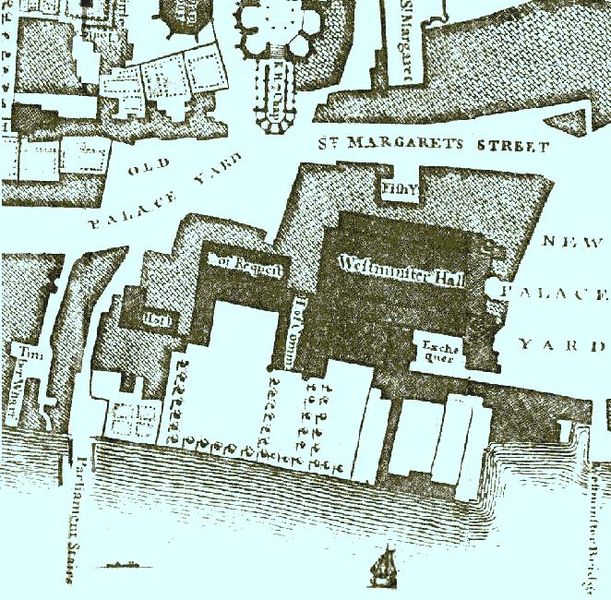
Detail of the Palace of Westminster from John Rocque's map of London in 1746. At this time the palace was an irregular group of buildings clustered around Westminster Hall. It was much smaller than the present building.
|
Aquest material està en domini públic als Estats Units i als altres països on el dret d'autor s'estén per 70 anys (o menys) després de la mort de l'autor. | |
| Aquest fitxer està identificat com a lliure de restriccions conegudes sota la llei de drets d'autor, inclosos els drets veïns. | |
Historial del fitxer
Cliqueu una data/hora per veure el fitxer tal com era aleshores.
| Data/hora | Miniatura | Dimensions | Usuari/a | Comentari | |
|---|---|---|---|---|---|
| actual | 19:34, 12 jul 2005 | | 662 × 650 (141 Ko) | Manchot sanguinaire~commonswiki | Detail of the Palace of Westminster from John Rocque's map of London in 1746. At this time the palace was an irregular group of buildings clustered around Westminster Hall. It was much smaller than the present building. {{PD}} |
Ús del fitxer
La pàgina següent utilitza aquest fitxer:
Ús global del fitxer
Utilització d'aquest fitxer en altres wikis:
- Utilització a bg.wikipedia.org
- Utilització a de.wikipedia.org
- Utilització a en.wikipedia.org
- Utilització a es.wikipedia.org
- Utilització a fr.wikipedia.org
- Utilització a it.wikipedia.org
- Utilització a ja.wikipedia.org
- Utilització a ko.wikipedia.org
- Utilització a mk.wikipedia.org
- Utilització a pt.wikipedia.org
- Utilització a zh.wikipedia.org
.jpg)