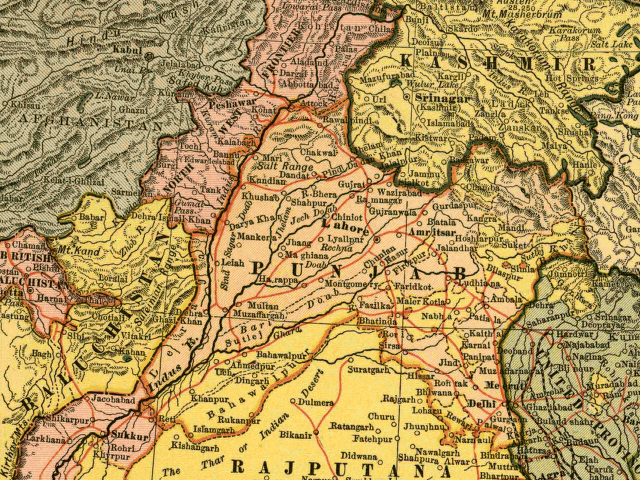
Fitxer:Punjab 1903.gif
Aparença
Punjab_1903.gif (640 × 480 píxels, mida del fitxer: 338 Ko, tipus MIME: image/gif)
Historial del fitxer
Cliqueu una data/hora per veure el fitxer tal com era aleshores.
| Data/hora | Miniatura | Dimensions | Usuari/a | Comentari | |
|---|---|---|---|---|---|
| actual | 13:54, 6 maig 2005 |  | 640 × 480 (338 Ko) | Shauni | In this map, the British Raj Punjab province is colored pink, and the Indian princely states are colored yellow. As the map indicates, a number of princely states, mostly in the eastern Punjab, fell under the political authority of the British Gov |
Ús del fitxer
La pàgina següent utilitza aquest fitxer:
Ús global del fitxer
Utilització d'aquest fitxer en altres wikis:
- Utilització a ar.wikipedia.org
- Utilització a bg.wikipedia.org
- Utilització a bn.wikipedia.org
- Utilització a br.wikipedia.org
- Utilització a en.wikipedia.org
- Utilització a es.wikipedia.org
- Utilització a fi.wikipedia.org
- Utilització a hi.wikipedia.org
- Utilització a it.wikipedia.org
- Utilització a ko.wikipedia.org
- Utilització a ml.wikipedia.org
- Utilització a nn.wikipedia.org
- Utilització a pnb.wikipedia.org
- Utilització a ur.wikipedia.org
- Utilització a www.wikidata.org
- Utilització a zh.wikipedia.org


