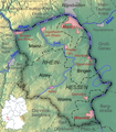
Fitxer:Rheinhessen Relief Karte.png
Aparença

Mida d'aquesta previsualització: 522 × 599 píxels. Altres resolucions: 209 × 240 píxels | 418 × 480 píxels | 669 × 768 píxels | 1.031 × 1.183 píxels.
Fitxer original (1.031 × 1.183 píxels, mida del fitxer: 1,23 Mo, tipus MIME: image/png)
Historial del fitxer
Cliqueu una data/hora per veure el fitxer tal com era aleshores.
| Data/hora | Miniatura | Dimensions | Usuari/a | Comentari | |
|---|---|---|---|---|---|
| actual | 12:59, 6 maig 2020 |  | 1.031 × 1.183 (1,23 Mo) | Ras67 | cropped, opt. |
| 21:34, 18 des 2008 |  | 1.047 × 1.200 (1,28 Mo) | Lencer | {{Information| |Description=Relief und Topographie von Rheinhessen |Source=own work, used [http://www.maps-for-free.com/ Google Maps-For-Free] SRTM3 Webserver, [http://www.demis.nl/home/pages/wms/demiswms.htm Demis Webserver], small m |
Ús del fitxer
La pàgina següent utilitza aquest fitxer:
Ús global del fitxer
Utilització d'aquest fitxer en altres wikis:
- Utilització a af.wikipedia.org
- Utilització a da.wikipedia.org
- Utilització a de.wikipedia.org
- Utilització a de.wikivoyage.org
- Utilització a en.wikipedia.org
- Utilització a en.wikivoyage.org
- Utilització a eo.wikipedia.org
- Utilització a es.wikipedia.org
- Utilització a fr.wikipedia.org
- Utilització a id.wikipedia.org
- Utilització a lt.wikipedia.org
- Utilització a nl.wikipedia.org
- Utilització a no.wikipedia.org
- Utilització a pfl.wikipedia.org
- Utilització a pl.wikipedia.org
- Utilització a pt.wikipedia.org
- Utilització a ro.wikipedia.org
- Utilització a ru.wikipedia.org
- Utilització a vi.wikipedia.org
- Utilització a www.wikidata.org


