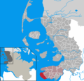
Fitxer:Sankt Peter-Ording in NF.PNG
Aparença
Sankt_Peter-Ording_in_NF.PNG (353 × 340 píxels, mida del fitxer: 8 Ko, tipus MIME: image/png)
Historial del fitxer
Cliqueu una data/hora per veure el fitxer tal com era aleshores.
| Data/hora | Miniatura | Dimensions | Usuari/a | Comentari | |
|---|---|---|---|---|---|
| actual | 14:37, 9 oct 2019 |  | 353 × 340 (8 Ko) | NordNordWest | upd |
| 20:18, 8 gen 2008 |  | 353 × 340 (7 Ko) | Ditschi | Amtsmitgliedschaft Amt Eiderstedt | |
| 20:07, 21 gen 2007 |  | 353 × 340 (7 Ko) | Ditschi | Corrections in Klanxbüll and Rodenäs, Reußenköge and Ockholm | |
| 16:32, 6 set 2006 |  | 353 × 340 (7 Ko) | ClausG | {{GFDL}} == Beschreibung == * en: This map shows the area of the Gemeinde (municipality) Sankt Peter-Ording in the Kreis (district) Nordfriesland, Schleswig-Holstein, Germany. * de: Diese Karte zeigt das Gebiet der Gemeinde [[: |
Ús del fitxer
La pàgina següent utilitza aquest fitxer:
Ús global del fitxer
Utilització d'aquest fitxer en altres wikis:
- Utilització a da.wikipedia.org
- Utilització a de.wikipedia.org
- Utilització a en.wikipedia.org
- Utilització a eo.wikipedia.org
- Utilització a es.wikipedia.org
- Utilització a eu.wikipedia.org
- Utilització a frr.wikipedia.org
- Utilització a fy.wikipedia.org
- Utilització a hu.wikipedia.org
- Utilització a it.wikipedia.org
- Utilització a mk.wikipedia.org
- Utilització a nl.wikipedia.org
- Utilització a pl.wikipedia.org
- Utilització a sh.wikipedia.org
- Utilització a sr.wikipedia.org
- Utilització a sv.wikipedia.org
- Utilització a tr.wikipedia.org
- Utilització a tt.wikipedia.org
- Utilització a uk.wikipedia.org
- Utilització a vi.wikipedia.org
- Utilització a www.wikidata.org
- Utilització a zh-min-nan.wikipedia.org


