Vés al contingut

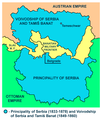
Fitxer:Serbia02.png

El contingut de la pàgina no s'admet en altres llengües.
De la Viquipèdia, l'enciclopèdia lliure

Fitxer original (724 × 949 píxels, mida del fitxer: 73 Ko, tipus MIME: image/png)

Descripció a Commons

Resum

Descripció
English: Two autonomous historical territories named Serbia: 1. Principality of Serbia within Ottoman Empire (1833-1878), and 2. Voivodeship of Serbia and Banat of Temeschwar within Austrian Empire (1849-1860)
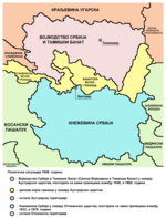
Српски / srpski: Две аутономне историјске територије са називом Србија: 1. Кнежевина Србија у оквиру Отоманског царства (1833-1878) и 2. Војводство Србија и Тамишки Банат у оквиру Аустријског царства (1849-1860)
Data
Font
Atlas This map has been uploaded by Electionworld from en.wikipedia.org to enable the Wikimedia Atlas of the World . Original uploader to en.wikipedia.org was PANONIAN, known as PANONIAN at en.wikipedia.org. Electionworld is not the creator of this map. Licensing information is below.
Autor Self-made map by PANONIAN
Permís
(Com reutilitzar aquest fitxer)
Public domain S'ha alliberat aquesta obra al domini públic pel seu autor PANONIAN. Això s'aplica a tot el món.

En alguns països això pot no ser legalment possible, en tal cas:
PANONIAN concedeix a tothom el dret d'usar aquesta obra per a qualsevol propòsit, sense cap condició llevat d'aquelles requerides per la llei.

Altres versions Serbian language Cyrillic script version Serbian language Latin script version

References

Published references:

  • The Times History of Europe, Times Books, 2002.
  • Sima M. Ćirković, Srbi među evropskim narodima, Beograd, 2004.
  • Dr Tomislav Bogavac, Nestajanje Srba, Niš, 1994.
  • Dragomir Jankov, Vojvodina - propadanje jednog regiona, Novi Sad, 2004.
  • Istorijski atlas, Zavod za udžbenike i nastavna sredstva - Zavod za kartografiju "Geokarta", Beograd, 1999.
  • Školski istorijski atlas, Zavod za izdavanje udžbenika Socijalističke Republike Srbije, Beograd, 1970.
  • Peter Rokai - Zoltan Đere - Tibor Pal - Aleksandar Kasaš, Istorija Mađara, Beograd, 2002.
  • Lazo M. Kostić, Srpska Vojvodina i njene manjine, Novi Sad, 1999.
  • Drago Njegovan, Prisajedinjenje Vojvodine Srbiji, Novi Sad, 2004.
  • Čedomir Popov - Jelena Popov, Autonomija Vojvodine - srpsko pitanje, Sremski Karlovci, 2000.
  • Dr Dušan J. Popović, Srbi u Vojvodini, knjiga 3, Novi Sad, 1990.
  • J. H. Šviker, Politička istorija Srba u Ugarskoj, Novi Sad - Beograd, 1998.
  • Sigfrid Kaper, Srpski pokret u južnoj Ugarskoj 1848-1849, Beograd - Valjevo, 1996.
  • Dimitrije Boarov, Politička istorija Vojvodine, Novi Sad, 2001.
  • Dejan Mikavica, Srpska Vojvodina u Habsburškoj monarhiji 1690-1920, Novi Sad, 2005.
  • Dr Milenko Palić, Srbi u Mađarskoj - Ugarskoj do 1918, Novi Sad, 1995.
  • Drago Njegovan, Srpska Vojvodina, Enciklopedija Novog Sada, knjiga 26, Novi Sad, 2005.
  • Istorija Vojvodine, Enciklopedija Novog Sada, sveska 5, Novi Sad, 1996.
  • Vladimir Ćorović, Ilustrovana istorija Srba, knjiga peta, Beograd, 2006.
  • Vasilije Krestić, Iz prošlosti Srema, Bačke i Banata, Beograd, 2003.
  • Slavko Gavrilović, Srbi u Habsburškoj Monarhiji (1792-1849), Novi Sad, 1994.
  • Milan Tutorov, Banatska rapsodija, Novi Sad, 2001.
  • Jovan M. Pejin, Iz prošlosti Kikinde, Kikinda, 2000.
  • Rodoljub Malenčić, Miletić, Novi Sad, 1996.
  • Čedomir Popov - Slavko Gavrilović, Evropska revolucija i srpski pokret 1848-1849, Beograd - Novi Sad, 1997.

Internet references:

Llegendes

Afegeix una explicació d'una línia del que representa aquest fitxer

Elements representats en aquest fitxer

representa l'entitat

Historial del fitxer

Cliqueu una data/hora per veure el fitxer tal com era aleshores.

Data/horaMiniaturaDimensionsUsuari/aComentari
actual15:17, 8 oct 2013Miniatura per a la versió del 15:17, 8 oct 2013724 × 949 (73 Ko)WikiEditor2004aesthetics
11:20, 24 des 2009Miniatura per a la versió del 11:20, 24 des 2009717 × 944 (73 Ko)WikiEditor2004aesthetics
19:50, 1 juny 2009Miniatura per a la versió del 19:50, 1 juny 2009717 × 944 (73 Ko)WikiEditor2004
23:19, 13 feb 2008Miniatura per a la versió del 23:19, 13 feb 2008522 × 557 (28 Ko)Imbris~commonswikiThe image must be free of POV. The image I'am proposing is using different colours for the Principality of Serbia and Serb Voivodship and Tamiš Banate.
12:58, 1 maig 2007Miniatura per a la versió del 12:58, 1 maig 2007522 × 613 (70 Ko)Tene~commonswikiOptimised (0)
22:40, 21 des 2006Miniatura per a la versió del 22:40, 21 des 2006522 × 613 (87 Ko)Electionworld{{ew|en|PANONIAN}} Self-made map by PANONIAN {{PD-user|PANONIAN}} Category:Maps of Serbia

Les 2 pàgines següents utilitzen aquest fitxer:

Ús global del fitxer

Utilització d'aquest fitxer en altres wikis: