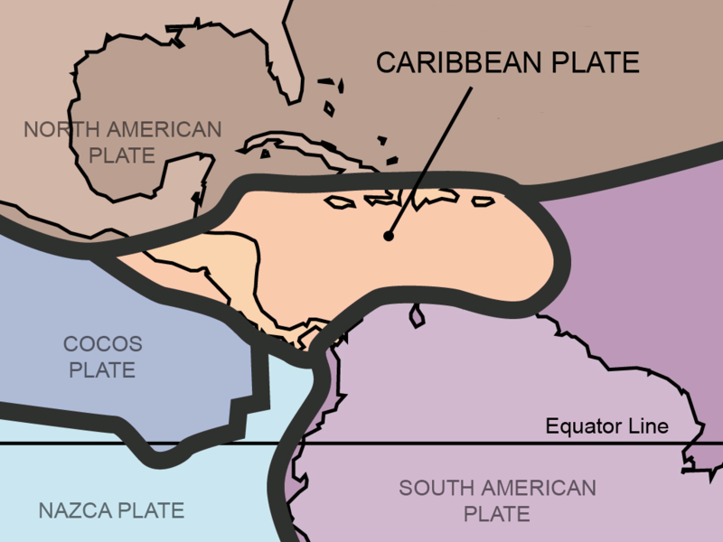
Fitxer:Tectonic plates Caribbean.png
Aparença

Mida d'aquesta previsualització: 800 × 600 píxels. Altres resolucions: 320 × 240 píxels | 640 × 480 píxels | 1.024 × 768 píxels.
Fitxer original (1.024 × 768 píxels, mida del fitxer: 64 Ko, tipus MIME: image/png)
Historial del fitxer
Cliqueu una data/hora per veure el fitxer tal com era aleshores.
| Data/hora | Miniatura | Dimensions | Usuari/a | Comentari | |
|---|---|---|---|---|---|
| actual | 02:32, 16 feb 2013 |  | 1.024 × 768 (64 Ko) | JohnnyMrNinja | reduce size over 3x with color indexing and slightly higher compression |
| 21:51, 31 ago 2011 |  | 1.024 × 768 (211 Ko) | AlexCovarrubias | Centered map on the Caribbean Plate. | |
| 17:30, 5 feb 2006 |  | 3.000 × 2.250 (1,1 Mo) | Maksim | La bildo estas kopiita de wikipedia:en. La originala priskribo estas: {{PD-self}} This work was derived from Image:Tectonic_plates.png, an image in the public domain (PD-USGov-Interior-USGS). {| border="1" ! date/time || username || edit summary |---- |
Ús del fitxer
La pàgina següent utilitza aquest fitxer:
Ús global del fitxer
Utilització d'aquest fitxer en altres wikis:
- Utilització a ar.wikipedia.org
- Utilització a be.wikipedia.org
- Utilització a bo.wikipedia.org
- Utilització a bs.wikipedia.org
- Utilització a da.wikipedia.org
- Utilització a de.wikipedia.org
- Utilització a en.wikipedia.org
- Utilització a eo.wikipedia.org
- Utilització a es.wikipedia.org
- Utilització a eu.wikipedia.org
- Utilització a fa.wikipedia.org
- Utilització a fi.wikipedia.org
- Utilització a fr.wikipedia.org
- Utilització a fy.wikipedia.org
- Utilització a ga.wikipedia.org
- Utilització a he.wikipedia.org
- Utilització a hi.wikipedia.org
- Utilització a hu.wikipedia.org
- Utilització a hy.wikipedia.org
- Utilització a it.wikipedia.org
- Utilització a ja.wikipedia.org
- Utilització a ka.wikipedia.org
- Utilització a km.wikipedia.org
Vegeu més usos globals d'aquest fitxer.


