Vés al contingut

Fitxer:The Ancient Roads of Italy and Sicily nopng.svg

El contingut de la pàgina no s'admet en altres llengües.
De la Viquipèdia, l'enciclopèdia lliure

Fitxer original (fitxer SVG, nominalment 1.201 × 1.340 píxels, mida del fitxer: 245 Ko)

Descripció a Commons

Resum

Descripció
English:
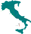
The major roads of Italy (going from Rome) are as follows, going clockwise from the left:


Green: Via Aurelia -> Via Aumelia Scaura -> Via Julia Augusta Bright green: Via Clodia
Yellow: Via Cassia
Blue: Via Flaminia
Grey: Via Salaria
Dark purple -> purple: Via Tiburtina -> Via Valeria
Carrot red: Via Latina
Bright red: Via Appia
Dark blue: Via Ostiensis

Additional major roads specified on the map:
Via Popilia, going to southern Italy (Rhegium) from Via Latina
and Via Appia crossroads. (cyan)
Via Traiana, branching from Via Appia and also going to Brundisium. (dark red)
Via Aemilia, starting from the end of Via Flaminia at Ariminum and going to Placentia. (orange)
Via Postumia, going from Genua (Genoa) on the northwest of Italy to Aquileia on the northeast. (dark green)
== Licensing ==

Public domain Jo, el titular del copyright d'aquesta obra, l'allibero al domini públic. Això s'aplica a tot el món.
En alguns països això pot no ser legalment possible, en tal cas:
Jo faig concessió a tothom del dret d'usar aquesta obra per a qualsevol propòsit, sense cap condició llevat d'aquelles requerides per la llei.


The data from this map was collected from pages 26, 27, 30, and 31 of the 1926 edition of the "Historical Atlas", by William R. Shepherd. The scans used to trace the paths were downloaded from the University of Texas Libraries at:
http://www.lib.utexas.edu/maps/historical/history_shepherd_1923.html

Specifically:
http://www.lib.utexas.edu/maps/historical/shepherd/italy_ancient_north.jpg
http://www.lib.utexas.edu/maps/historical/shepherd/italy_ancient_south.jpg

I cannot find the latest date these roads were all built in except to say that they were all extremely likely to have been built before 476AD, the ceremonial demise of the Western Roman Empire.

I could add the PNG background but I am as yet unsure how I would embed it in an svg.


Corrections and additions are welcome!
Data
Font Treball propi
Creador
Georeferencing Georeference the map in Wikimaps Warper If inappropriate please set warp_status = skip to hide.
Altres versions


Llicència

Public domain Jo, el titular del copyright d'aquesta obra, l'allibero al domini públic. Això s'aplica a tot el món.
En alguns països això pot no ser legalment possible, en tal cas:
Jo faig concessió a tothom del dret d'usar aquesta obra per a qualsevol propòsit, sense cap condició llevat d'aquelles requerides per la llei.

Llegendes

Afegeix una explicació d'una línia del que representa aquest fitxer

Elements representats en aquest fitxer

representa l'entitat

Historial del fitxer

Cliqueu una data/hora per veure el fitxer tal com era aleshores.

Data/horaMiniaturaDimensionsUsuari/aComentari
actual02:24, 24 abr 2020Miniatura per a la versió del 02:24, 24 abr 20201.201 × 1.340 (245 Ko)CiaurlecChanged alpha channel values to make it lighter
09:07, 20 feb 2010Miniatura per a la versió del 09:07, 20 feb 20101.201 × 1.340 (245 Ko)AgamemnusBringing back a road that went missing.
05:25, 13 feb 2010Miniatura per a la versió del 05:25, 13 feb 20101.201 × 1.340 (239 Ko)AgamemnusOne more color change.
05:19, 13 feb 2010Miniatura per a la versió del 05:19, 13 feb 20101.201 × 1.340 (239 Ko)AgamemnusColor change..
05:14, 13 feb 2010Miniatura per a la versió del 05:14, 13 feb 20101.201 × 1.340 (239 Ko)AgamemnusMinor road edit.
05:04, 13 feb 2010Miniatura per a la versió del 05:04, 13 feb 20101.201 × 1.340 (238 Ko)AgamemnusAdded a little compass showing north. Added a scale strip next to the compass. Changed Via Tiburtina color to dark purple.
19:05, 9 feb 2010Miniatura per a la versió del 19:05, 9 feb 20101.201 × 1.340 (230 Ko)AgamemnusMoved the italy/sicily svg down so the roads could be seen again...
09:18, 9 feb 2010Miniatura per a la versió del 09:18, 9 feb 20101.201 × 1.340 (230 Ko)AgamemnusTeh Sicily portion of the SVG is now more detailed.
06:16, 9 feb 2010Miniatura per a la versió del 06:16, 9 feb 20101.201 × 1.340 (220 Ko)Agamemnus{{Information |Description={{en|1=The major roads of Italy (going from Rome) are as follows, going clockwise from the left: Green: Via Aurelia -> Via Aumelia Scaura -> Via Julia Augusta Bright green: Via Clodia Yellow: Via Cassia Blue: Via Flaminia Grey:

La pàgina següent utilitza aquest fitxer:

Ús global del fitxer

Utilització d'aquest fitxer en altres wikis:

Metadades