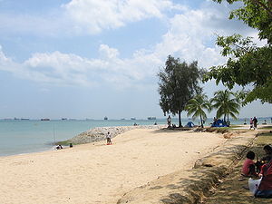
Estret de Singapur
| Tipus | estret | |||
|---|---|---|---|---|
| ||||
| Afluents | ||||
| Característiques | ||||
| Travessa | Malàisia, Singapur i Indonèsia | |||


L'Estret de Singapur, en anglès:Singapore Strait ((xinès); Malai: Selat Singapura) és un estret de 114 km de llargada i 16 km d'amplada entre l'Estret de Malaca a l'oest i la Mar de la Xina Meridional a l'est. Singapur és al nord del canal i l'arxipèlag Riau es troba al sud. La frontera amb Indonèsia es troba junt a la llargada de l'estret.
Inclous Port Keppel i moltes petites illes. L'estret és un passatge ambaigües profundes cap el Port de Singapur. Aproximadament 2.000 vaixells mercants travessen cada dia aquest estret.[1]
Durant la Segona Guerra Mundial l'estret va ser minat.[2]
Extensió
[modifica]La International Hydrographic Organization defineix el límits de l'Estret de Singapur com segueix:[3]
A l'Oest. El límit oriental de l'estret de Malaca [una línia que uneix Tanjung Piai (Bulus), l'extremitat sud de la Península de Malàisia] (1° 16′ N, 103° 31′ E / 1.267°N,103.517°E) i The Brothers (1° 11.5′ N, 103° 21′ E / 1.1917°N,103.350°E) i a Klein Karimoen (1° 10′ N, 103° 23.5′ E / 1.167°N,103.3917°E)].
A l'Est. Una línia que uneix Tanjong Datok, el punt sud-est de Johor (1° 22′ N, 104° 17′ E / 1.367°N,104.283°E) a través de l'Horsburgh Reef a Pulo Koko, l'extrem nord-est de l'illa de Bintan (1° 13.5′ N, 104° 35′ E / 1.2250°N,104.583°E).
Al Nord. La riba sud de l'illa de Singapur, Johore Shoal i la costa sud-est de la Península de Malàisia.
Al Sud. Una línia que uneix Klein Karimoen amb Pulo Pemping Besar (1° 06.5′ N, 103° 47.5′ E / 1.1083°N,103.7917°E) des d'allí al llarg de les costes del nord de Batam i les Illes Bintan fins a Pulo Koko.
Referències
[modifica]- ↑ Liang, Annabelle; Maye-E, Wong «Busy waters around Singapore carry a host of hazards». Navy Times, 22-08-2017. «Around 2,000 merchant ships travel in the area every day, Tan estimated.»
- ↑ «SINGAPORE STRAIT MINED.». The Central Queensland Herald (Rockhampton, Qld. : 1930 - 1956). National Library of Australia [Rockhampton, Qld.], 20-02-1941, p. 34 [Consulta: 12 maig 2012].
- ↑ «Limits of Oceans and Seas, 3rd >edition». International Hydrographic Organization, 1953. Arxivat de l'original el 8 d’octubre 2011. [Consulta: 7 febrer 2010].
- Borschberg, Peter, "Singapura in Early Modern Cartography: A Sea of Challenges", in Visualising Space. Maps of Singapore and the Region. Collections from the National Library and National Archives of Singapore (Singapore: NLB, 2015): 6-33. https://www.academia.edu/8681191
- Borschberg, Peter, The Singapore and Melaka Straits. Violence, Security and Diplomacy in the 17th Century, Singapore and Leiden: NUS Press and KITLV Press, 2010. https://www.academia.edu/4302722
- Borschberg, Peter, Jacques de Coutre's Singapore and Johor, 1595-c1625, Singapore: NUS Press, 2015. https://www.academia.edu/9672124
- Borschberg, Peter, Admiral Matelieff's Singapore and Johor, 1606-1616, Singapore, 2015. https://www.academia.edu/11868450
- Borschberg, Peter, “The Singapore Straits in the Latter Middle Ages and Early Modern Period (c.13th to 17th Centuries). Facts, Fancy and Historiographical Challenges”, Journal of Asian History, 46.2 (2012): 193-224. https://www.academia.edu/4285020
- Borschberg, Peter, “The Straits of Singapore: Continuity, Change and Confusion”, in Sketching the Straits. A Compilation of the Lecture Series on the Charles Dyce Collection, ed. Irene Lim (Singapore: NUS Museums, 2004): 33-47. https://www.academia.edu/4311413
- Borschberg, Peter, "Singapore and its Straits, 1500-1800", Indonesia and the Malay World 43, 3 (2017) https://www.tandfonline.com/doi/full/10.1080/13639811.2017.1340493
- Borschberg, Peter, "Singapore in the Cycles of the Longue Duree", Journal of the Malaysian Branch of the Royal Asiatic Society, 90 (1) (2017), pp. 32-60. https://muse.jhu.edu/article/663863/summary
- Gibson-Hill, Carl-Alexander, "Singapore: Note on the History of the Old Straits, 1580–1850", Journal of the Malayan Branch of the Royal Asiatic Society, 27.1 (1954): 165-214.


