Vés al contingut

Fitxer:Rzeczpospolita 1937.svg

El contingut de la pàgina no s'admet en altres llengües.
De la Viquipèdia, l'enciclopèdia lliure

Fitxer original (fitxer SVG, nominalment 2.220 × 1.554 píxels, mida del fitxer: 573 Ko)

Descripció a Commons

Resum

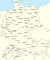
Descripció Test version of a vectorized File:Rzeczpospolita 1920.png; more changes will follow, only checking if wiki displays it right
Data
Font

Treball propi; based on an earlier raster map made in 2005, as well as similar maps made by myself in 2004 (see below).
In preparation of this map I used many other maps as sources and backup. Among them were:

  • a German roadmap of Poland printed in 1938 (colours and the shape of East Prussian border)
  • and perhaps a dozen others.
Autor Halibutt
Altres versions
SVG genesis
InfoField
 
El codi font d’aquest SVG no és vàlid perquè hi 2 han errors.
 
Aquesta imatge vectorial ha estat creada amb Adobe Illustrator,
 
and with Inkscape.
 
 This map uses embedded text that can be easily translated using a text editor.


Copyright notice: Image made by Halibutt and uploaded to Wikipedia by the author. Images can be made available for use under other copyleft licenses on a case by case basis via direct contact with the author. Under moral rights the user requires that this work be properly attributed to its creator. For photographs, this is traditionally done in the image caption. Where a copyright notice is present, using the copyright notice in the caption will be sufficient. Note that the GFDL requires that any copyright notices be included with the work even when making unmodified use of it.

Since the legal status of the above comment has been questioned, I hereby grant anyone the right to treat it as either a standard copyright notice, invariant section, legal statement, legal advice, friendly suggestion or a mere comment, depending on his or hers own choice.
Halibutt
GNU head S'autoritza la còpia, la distribució i la modificació d'aquest document sota els termes de la llicència de documentació lliure GNU versió 1.2 o qualsevol altra versió posterior que publiqui la Free Software Foundation; sense seccions invariants, ni textos de portada, ni textos de contraportada. S'inclou una còpia d'aquesta llicència en la secció titulada GNU Free Documentation License.
w:ca:Creative Commons
reconeixement compartir igual
Aquest fitxer està subjecte a la llicència de Creative Commons Reconeixement i Compartir Igual 3.0 No adaptada.
Sou lliure de:
  • compartir – copiar, distribuir i comunicar públicament l'obra
  • adaptar – fer-ne obres derivades
Amb les condicions següents:
  • reconeixement – Heu de donar la informació adequada sobre l'autor, proporcionar un enllaç a la llicència i indicar si s'han realitzat canvis. Podeu fer-ho amb qualsevol mitjà raonable, però de cap manera no suggereixi que l'autor us dóna suport o aprova l'ús que en feu.
  • compartir igual – Si modifiqueu, transformeu, o generareu amb el material, haureu de distribuir les vostres contribucions sota una llicència similar o una de compatible com l'original
Aquest avís de llicència s'ha afegit a aquest fitxer d'acord amb l'actualització de la llicència GFDL.

The following is a list of maps created by Halibutt and uploaded to commons, as well as their present and projected derivatives.

Parent Image Image Description
  Maps by Halibutt
Image:Rzeczpospolita.png Image:Rzeczpospolita.png The Republic in 17th and 18th century
Image:Rzeczpospolita 1600.png The Republic after the Treaty of Dywilino
Image:Rzeczpospolita voivodships.png Voivodships of The Republic
Image:Rzeczpospolita_Potop.png The Republic during The Deluge and Chmielnicki Uprising, with major battles of the era marked
Magnates and their lands and domains
1st2nd3rd Partitions of Poland
War of the constitution
Image:Rzeczpospolita.xcf SOURCE FILE - GIMP format
Image:Poland 1939.png Image:Poland 1939.png Poland in 1939
Image:Dywizje wrzesien 1.png Order of Battle on September 1st, during the Polish Defence War of 1939
Image:Poland 1939.xcf SOURCE FILE - GIMP format
Image:Polska kontur bialy.png Image:Polska kontur bialy.png Contour map of Poland AD 1999, for use with various locator maps
Image:Rzeczpospolita 1923.png Image:Rzeczpospolita 1923.png Map of Poland 1918-1939, currently under development
Image:PBW March 1919.png Polish-Bolshevik War - fronts in March of 1919
Image:PBW December 1919.png Polish-Bolshevik War - fronts in December of 1919
Image:PBW June 1920.png Polish-Bolshevik War - fronts in July of 1920
Image:PBW August 1920.png Polish-Bolshevik War - fronts in August of 1920
Polish Defence War of 1939
Polish areas annexed by Germany, Lithuania, Slovakia and the Soviet Union
German concentration camps in Poland
Curzon line
Major battles of the Polish-Bolshevik War
namesno names Polish/Czechoslovak/Lithuanian/German/Ukrainian claims in 1920's
Image:Rzeczpospolita Central Lithuania.png Central Lithuania
Image:Rzeczpospolita Lithuania claims.png Central Lithuania as compared with other Lithuanian claims
Image:Rzeczpospolita 1789-1920.png Post-1922 borders compared with the territory of Poland before the partitions
Warsaw Uprising and the Operation Tempest
Poland partitioned between the Soviets and the Germans
Image:Rzeczpospolita 1939 Polish divisions.png Polish divisions on September 1, 1939
Home Army inspectorates
Image:Rzeczpospolita 1922.xcf SOURCE FILE - GIMP format
Image:Rzeczpospolita 1937.svg Vector version!!!! layered version available on request

Llegendes

Afegeix una explicació d'una línia del que representa aquest fitxer

Elements representats en aquest fitxer

representa l'entitat

Historial del fitxer

Cliqueu una data/hora per veure el fitxer tal com era aleshores.

(les més noves | les més antigues) Mostra (10 posteriors | ) (10 | 20 | 50 | 100 | 250 | 500)
Data/horaMiniaturaDimensionsUsuari/aComentari
actual16:24, 1 gen 2017Miniatura per a la versió del 16:24, 1 gen 20172.220 × 1.554 (573 Ko)Sascha GPDMalmö (duplicate) -> Göteborg
15:34, 30 jul 2013Miniatura per a la versió del 15:34, 30 jul 20132.220 × 1.554 (573 Ko)HalibuttAdded some rivers in Russia, corrected others (RO, HU, PL)
04:28, 30 jul 2013Miniatura per a la versió del 04:28, 30 jul 20132.220 × 1.563 (458 Ko)HalibuttSweden corrected (town names added)
04:16, 30 jul 2013Miniatura per a la versió del 04:16, 30 jul 20132.214 × 1.567 (492 Ko)Halibuttcrunched version (deleted background layers)
04:13, 30 jul 2013Miniatura per a la versió del 04:13, 30 jul 20132.214 × 1.567 (3,68 Mo)Halibuttlet's see if the expanded version works
19:11, 16 jul 2010Miniatura per a la versió del 19:11, 16 jul 20102.014 × 1.567 (534 Ko)HierakaresCorrected position of name Oppeln which was overlapping with point.
09:54, 14 març 2008Miniatura per a la versió del 09:54, 14 març 20082.014 × 1.567 (534 Ko)HalibuttNames of larger towns enlarged
09:45, 14 març 2008Miniatura per a la versió del 09:45, 14 març 20082.014 × 1.567 (533 Ko)Halibuttversion corrected by Madman
01:30, 14 març 2008Miniatura per a la versió del 01:30, 14 març 20082.000 × 1.534 (512 Ko)Halibutt{{Information |Description= |Source=self-made |Date= |Author= Halibutt |Permission= |other_versions= }}
00:54, 14 març 2008Miniatura per a la versió del 00:54, 14 març 20082.000 × 1.534 (548 Ko)Halibutt{{Information |Description= |Source=self-made |Date= |Author= Halibutt |Permission= |other_versions= }}
(les més noves | les més antigues) Mostra (10 posteriors | ) (10 | 20 | 50 | 100 | 250 | 500)

Ús global del fitxer

Utilització d'aquest fitxer en altres wikis:

Vegeu més usos globals d'aquest fitxer.

Metadades