Pontanus (cràter)
 | |
| Dades generals | |
| Tipus | cràter d'impacte |
| Cos astronòmic | Lluna |
| Epònim | Giovanni Pontano |
| Dades geogràfiques | |
| Coordenades | 28° 25′ S, 14° 22′ E / 28.42°S,14.36°E |
| Diàmetre | 55,7 km |
| Quadrangle | LQ20 |
| Localització | |
| Identificadors | |
| Gazetteer of Planetary Nomenclature | 4797 |

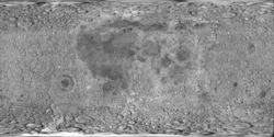
Pontanus és un cràter d'impacte pertanyent a les escarpades terres altes de la zona sud de la cara visible de la Lluna. Es troba aproximadament a mig camí entre els cràters Sacrobosco al nord-nord-est i Gemma Frisius al sud-sud-oest. Té 58 quilòmetres de diàmetre i 2.120 metres de profunditat.[1]

La vora d'aquest cràter ha estat fortament desgastada per impactes posteriors, deixant un perfil aproximadament circular, desigual sobre la plataforma interior. Presenta una protrusió cap a l'exterior en el sector sud del brocal. La vora i la paret interior en el costat nord són menys prominents, presentant incisions en la vora interior. El cràter satèl·lit Pontanus V està unit al costat oest-sud-oest. El sòl interior és relativament desigual, particularment en la meitat nord, però no està marcat per cap cràter significatiu.[2][3] [3] El cràter és del període Prenectarià, 4.55 a 3.92 mil milions anys enrere.
El cràter porta el nom del poeta italià del segle xv Giovanni Pontano.
Cràters satèl·lit
[modifica]Per convenció aquests elements són identificats en els mapes lunars posant la lletra en el costat del punt central del cràter que està més proper a Pontanus. [4]
Vegeu també
[modifica]Referències
[modifica]- ↑ Autostar Suite Astronomer Edition. CD-ROM. Meade, April 2006.
- ↑ Rükl Antonín. Kalmbach Books. Atlas of the Moon, 1990. ISBN 0-913135-17-8.
- ↑ 3,0 3,1 Moore, Patrick (2001). On the Moon. Sterling Publishing Co.. ISBN 0-304-35469-4.
- ↑ Bussey, B.; Spudis, P.. Cambridge University Press. The Clementine Atlas of the Moon, 2004. ISBN 0-521-81528-2.
Altres referències
[modifica]- (WGPSN), IAU Working Group for Planetary System Nomenclature. «Gazetteer of Planetary Nomenclature. 1:1 Million-Scale Maps of the Moon» (en anglès). UAI / USGS, 13-02-2013. [Consulta: 6 abril 2016].
- Andersson, L. E.; Whitaker, E. A.,. NASA Catalogue of Lunar Nomenclature (en anglès). NASA RP-1097, 1982.
- Blue, Jennifer. «Gazetteer of Planetary Nomenclature» (en anglès). USGS, 25-07-2007. [Consulta: 2 gener 2012].
- Bussey, B.; Spudis, P.. The Clementine Atlas of the Moon (en anglès). Nueva York: Cambridge University Press, 2004. ISBN 0-521-81528-2.
- Cocks, Elijah E.; Cocks, Josiah C.. Who's Who on the Moon: A Biographical Dictionary of Lunar Nomenclature (en anglès). Tudor Publishers, 1995. ISBN 0-936389-27-3.
- McDowell, Jonathan. «Lunar Nomenclature» (en anglès). Jonathan's Space Report, 15-07-2007. [Consulta: 2 gener 2012].
- Menzel, D. H.; Minnaert, M.; Levin, B.; Dollfus, A.; Bell, B. «Report on Lunar Nomenclature by The Working Group of Commission 17 of the IAU» (en anglès). Space Science Reviews, 12, 1971, pàg. 136.
- Moore, Patrick. On the Moon (en anglès). Sterling Publishing Co, 2001. ISBN 0-304-35469-4.
- Price, Fred W. The Moon Observer's Handbook (en anglès). Cambridge University Press, 1988. ISBN 0521335000.
- Rükl, Antonín. Atlas of the Moon (en anglès). Kalmbach Books, 1990. ISBN 0-913135-17-8.
- Webb, Rev. T. W.. Celestial Objects for Common Telescopes, 6ª edición revisada (en anglès). Dover, 1962. ISBN 0-486-20917-2.
- Whitaker, Ewen A. Mapping and Naming the Moon (en anglès). Cambridge University Press, 2003. 978-0-521-54414-6.
- Wlasuk, Peter T. Observing the Moon (en anglès). Springer, 2000. ISBN 1-85233-193-3.
Enllaços externs
[modifica]- "Pontanus (cràter)". Gazetteer of Planetary Nomenclature. USGS Astrogeology Research Program. (anglès)
- «Digital Lunar Orbiter Photographic Atles of the Moon» (en anglès). [Consulta: 30 juny 2018].
- «LROC :: QuickMap - Targeting Mapa LROC» (en anglès). [Consulta: 30 juny 2018].
- «The-moon.wikispaces.com: Pontanus» (en anglès). Arxivat de l'original el 2018-05-30. [Consulta: 30 juny 2018].


