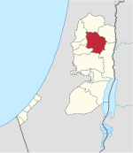
Beit Furik
Aparença
| Tipus | vila | |||
|---|---|---|---|---|
| Localització | ||||
| ||||
| Estat | Estat de Palestina | |||
| Territori ocupat | Cisjordània | |||
| Governacions | Governació de Nablus | |||
| Població humana | ||||
| Població | 13.477 (2017) | |||
| Geografia | ||||
| Superfície | 28.550 dúnams | |||
| Altitud | 417 m | |||
| Identificador descriptiu | ||||
| Codi postal | 470 | |||
| Fus horari | ||||
Beit Furik (àrab: بيت فوريك, Bayt Fūrīk) és un municipi palestí de la governació de Nablus, a Cisjordània, al nord de la vall del Jordà, 9 kilòmetres al sud-est de Nablus. Segons l'Oficina Central Palestina d'Estadístiques tenia 10.339 habitants en 2007.[1] Durant el segle xix i meitat del segle XX Beit Furik fou el principal proveïdor de calç per a la fabricació del sabó de Nabulsi a Nablus.[2]
Referències
[modifica]- ↑ 2007 PCBS Census Arxivat 2019-04-09 a Wayback Machine.. Palestinian Central Bureau of Statistics. p.110.
- ↑ Soap, Class, and State (1995) Doumani, Beshara. University of California.
Bibliografia
[modifica]- Barron, J. B.. Palestine: Report and General Abstracts of the Census of 1922. Government of Palestine, 1923.
- Conder, Claude Reignier; Kitchener, H.H.. The Survey of Western Palestine: Memoirs of the Topography, Orography, Hydrography, and Archaeology. 2. Londres: Comitè del Fons per a l'Exploració de Palestina, 1882. (p. 229)
- Conder, C. R. «Norman Palestine». Quarterly statement - Palestine Exploration Fund, 22, 1890, pàg. 29–37. (p. 32)
- Dauphin, Claudine. La Palestine byzantine, Peuplement et Populations (en francès). III : Catalogue. Oxford: Archeopress, 1998. (p. 848)
- Finkelstein, I.; Lederman, Zvi. Highlands of many cultures. Tel-Aviv: Institute of Archaeology of Tel Aviv University Publications Section, 1997. ISBN 965-440-007-3. (II p. 814)
- Guérin, V. Description Géographique Historique et Archéologique de la Palestine (en francès). 2: Samarie, pt. 1. París: L'Imprimerie Nationale, 1874. (p. 455)
- Hadawi, S. Village Statistics of 1945: A Classification of Land and Area ownership in Palestine. Palestine Liberation Organization Research Center, 1970.
- Hütteroth, Wolf-Dieter; Abdulfattah, Kamal. Historical Geography of Palestine, Transjordan and Southern Syria in the Late 16th Century. Erlanger Geographische Arbeiten, Sonderband 5. Erlangen, Germany: Vorstand der Fränkischen Geographischen Gesellschaft, 1977. ISBN 3-920405-41-2. (p. 132)
- Mills, E.. Census of Palestine 1931. Population of Villages, Towns and Administrative Areas. Jerusalem: Government of Palestine, 1932.
- Palmer, E. H.. The Survey of Western Palestine: Arabic and English Name Lists Collected During the Survey by Lieutenants Conder and Kitchener, R. E. Transliterated and Explained by E.H. Palmer. Comitè del Fons per a l'Exploració de Palestina, 1881. (p. 199)
- Robinson, E.; Smith, E. Biblical Researches in Palestine, Mount Sinai and Arabia Petraea: A Journal of Travels in the year 1838. 3. Boston: Crocker & Brewster, 1841. (p. 102)
- Röhricht, R. «Studien zur mittelalterlichen Geographie und Topographie Syriens». Zeitschrift des Deutschen Palästina-Vereins, 10, 1887, pàg. 195–344. (p. 205)
- Röhricht, Reinhold. (RRH) Regesta regni Hierosolymitani (MXCVII-MCCXCI) (en llatí). Berlín: Libraria Academica Wageriana, 1893. (p. 30, no. 121)


