Talfit
| تلفيت | ||||
| Tipus | poble | |||
|---|---|---|---|---|
| Localització | ||||
| ||||
| Vila | ||||
| Graella palestina | 177/165 | |||
| Geografia | ||||
| Altitud | 670 m | |||
| Organització política | ||||
| Governació | Nablus | |||
| Identificador descriptiu | ||||
| Fus horari | ||||
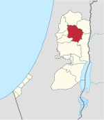
Talfit (àrab: تلفيت, Talfīt[1]) és un vila palestina de la governació de Nablus, a Cisjordània, al nord de la vall del Jordà, 21 kilòmetres al sud-est de Nablus. Segons l'Oficina Central Palestina d'Estadístiques tenia 2.824 habitants el 2007.[2]
Història
[modifica]S'hi ha trobat terrissa de l'Edat de Ferro i de les èpoques persa, romana d'Orient/aiúbida, mameluca i del primer període otomà.[3] Röhricht suggerí identificar Talfit amb Tarphin, mencionada en un text croat de 1154,[4] però un autor posterior (Abel) prefereix localitzar-la s Kh. Tarfein al nord de Bir Zeit.[5] Segons Finkelstein, Kh. Tarfein s'adapta millor a les troballes arqueològiques.[3]
Època otomana
[modifica]En 1596 Talfit apareix als registres fiscals otomans com a vila a la nàhiya de Jabal Qubal al liwà de Nablus. Tenia una població de 12 llars musulmanes i pagaven impostos sobre el blat, ordi, conreus d'estiu, oliveres, cabres i ruscs.[6]
El Survey of Western Palestine del Fons per a l'Exploració de Palestina en 1882 anomena a la vila Kabalan, i la descriu com de grandària moderada, en un terreny elevat envoltat d'oliveres. Talfit rebia el subministrament d'aigua des d'un pou anomenat Ain Telfit.[7]
Època del Mandat Britànic
[modifica]En el cens de Palestina de 1922 organitzat per les autoritats del Mandat Britànic de Palestina, Talfit tenia 352 habitants, tots musulmans.[8] que augmentà en el cens de 1931 a 464, tota musulmans en 116 llars.[9]
En el cens de 1945, Telfit tenia 610 musulmans,[10] amb 6.258 dúnams de terra, segons un cens oficial de terra i població.[11] D'aquests, 3,309 dúnams eren plantacions i terra de rec, 1,228 usats per cereals,[12] mentre 49 dúnams eren sòl edificat.[13]
Època moderna
[modifica]Després de la de la Guerra araboisraeliana de 1948, i després dels acords d'Armistici de 1949, Talfit va restar en mans de Jordània. Després de la Guerra dels Sis Dies el 1967, ha estat sota ocupació israeliana.
Referències
[modifica]- ↑ Palmer, 1881 p. 245
- ↑ 2007 PCBS Census. Palestinian Central Bureau of Statistics. p.110.
- ↑ 3,0 3,1 Finkelstein et al, 1997, p. 655
- ↑ Röhricht, 1887, p. 213
- ↑ Abel, 1928:52, cited in Finkelstein et al, 1997, p. 655
- ↑ Hütteroth and Abdulfattah, 1977, p. 133
- ↑ Conder and Kitchener, 1882, SWP II, p. 288
- ↑ Barron, 1923, Table IX, Sub-district of Nablus, p. 25
- ↑ Mills, 1932, p. 65
- ↑ Govern de Palestina, Departamento de Estadística, 1945, p. 19
- ↑ Government of Palestine, Department of Statistics. Village Statistics, April, 1945. Quoted in Hadawi, 1970, p. 61
- ↑ Government of Palestine, Department of Statistics. Village Statistics, April, 1945. Quoted in Hadawi, 1970, p. 108
- ↑ Government of Palestine, Department of Statistics. Village Statistics, April, 1945. Quoted in Hadawi, 1970, p. 158
Bibliografia
[modifica]- Barron, J.B.. Palestine: Report and General Abstracts of the Census of 1922. Government of Palestine, 1923.
- Conder, C.R.; Kitchener, H.H.. The Survey of Western Palestine: Memoirs of the Topography, Orography, Hydrography, and Archaeology. 2. Londres: Comitè del Fons per a l'Exploració de Palestina, 1882.
- Finkelstein, I.; Lederman, Zvi. Highlands of many cultures. Tel-Aviv: Institute of Archaeology of Tel Aviv University Publications Section, 1997. ISBN 965-440-007-3.
- Govern de Jordan, Departamento de Estadística. First Census of Population and Housing. Volume I: Final Tables; General Characteristics of the Population, 1964.
- Govern de Palestina, Departamento de Estadística. Village Statistics, April, 1945, 1945.
- Hadawi, S. Village Statistics of 1945: A Classification of Land and Area ownership in Palestine. Palestine Liberation Organization Research Center, 1970.
- Hütteroth, Wolf-Dieter; Abdulfattah, Kamal. Historical Geography of Palestine, Transjordan and Southern Syria in the Late 16th Century. Erlanger Geographische Arbeiten, Sonderband 5. Erlangen, Germany: Vorstand der Fränkischen Geographischen Gesellschaft, 1977. ISBN 3-920405-41-2.
- Mills, E.. Census of Palestine 1931. Population of Villages, Towns and Administrative Areas. Jerusalem: Government of Palestine, 1932.
- Palmer, E.H.. The Survey of Western Palestine: Arabic and English Name Lists Collected During the Survey by Lieutenants Conder and Kitchener, R. E. Transliterated and Explained by E.H. Palmer. Comitè del Fons per a l'Exploració de Palestina, 1881.
- Robinson, E.; Smith, E. Biblical Researches in Palestine, Mount Sinai and Arabia Petraea: A Journal of Travels in the year 1838. 3. Boston: Crocker & Brewster, 1841.
- Röhricht, R. «Studien zur mittelalterlichen Geographie und Topographie Syriens». Zeitschrift des Deutschen Palästina-Vereins, 10, 1887, pàg. 195–344.
Enllaços externs
[modifica]- Welcome To Talfit
- Survey of Western Palestine, Map 14: IAA, Wikimedia commons
- Talfit Village Profile, Applied Research Institute - Jerusalem, ARIJ
- Talfit, aerial photo, ARIJ


